|
search place name
|
||
Ban Nai Ram (Surat Thani, Thailand)Ban Nai Ram is a town in the Surat Thani region of Thailand. An overview map of the region around Ban Nai Ram is displayed below.
regional and 3d topo map of Ban Nai Ram, Thailand ::

Ban Nai Ram airports ::
The nearest airport is NST - Nakhon Si Thammarat Cha Ian, located 94.0 km south east of Ban Nai Ram.
Other airports nearby include HKT - Phuket Intl (178.6 km south west), TST - Trang (187.4 km south), Nearby towns ::
Ban Phuang (0.0km north) //
Ban Pak Nam Kradae (3.7km west) //
Ban Pak Nam Tha Thong (4.1km north west) //
Kanchanadit (6.6km south west) //
Ban Nong Suan (6.7km south west) //
Ban Khlong Thun (7.6km north) //
Ban Son (8.2km south west) //
Ban Don Ya (8.3km south west) //
Ban Don Yuan (9.2km north east) //
Ban Phot (9.2km north east) //
[all distances 'as the bird flies' and approximate] 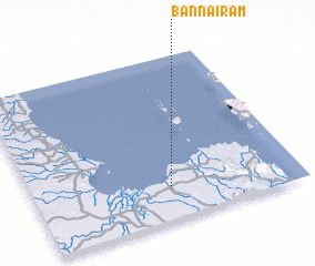 Places with similar names to Ban Nai Ram, Thailand ::
// Ben Rami (MA)
// Ban Niramai (TH)
// Ban Ram (TH)
// Ban Ram (TH)
// Ban Rom (TH)
// Benirrama (ES)
// Banerema (TP)
// Banoram (NG)
// Ban Ramay (LA)
// Bene Reʼem (IL)
Disclaimer :: Information on this page comes without warranty of any kind |
||
|
Where is Ban Nai Ram? Elevation and coordinates ::
Latitude (lat): 9°12'0"N Longitude (lon): 99°31'0"E
Elevation (approx.): 7m (map arrows pan, magnifying glasses zoom) |
||
|
Visiting Ban Nai Ram? Hotel/Accommodation ::
Book a hotel in Ban Nai Ram Travel Guide ::
Buy a travel guide for Thailand rental cars ::
car rental offers GPS waypoint ::
download a GPX waypoint (PoI) of Ban Nai Ram for your GPS receiver
|
||