|
search place name
|
||
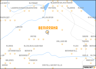
Benirrama (Comunidad Valenciana, Spain)Benirrama is a town in the Comunidad Valenciana region of Spain. An overview map of the region around Benirrama is displayed below.
regional and 3d topo map of Benirrama, Spain ::
Benirrama airports ::
The nearest airport is ALC - Alicante, located 68.7 km south west of Benirrama.
Other airports nearby include VLC - Valencia (76.8 km north), MJV - Murcia San Javier (129.1 km south west), IBZ - Ibiza (136.6 km east), Nearby towns ::
Benisivá (2.3km south west) //
Beniali (2.3km south west) //
Benitaya (2.3km south west) //
Carroja (3.4km south west) //
Villalonga (5.6km north) //
Patró (4.7km south west) //
Adsubia (4.7km north east) //
Forna (6.3km north east) //
Vall de Ebo (5.7km south east) //
Benisili (6.1km west) //
Llombay (6.1km west) //
Alcalá de la Jovada (7.0km south west) //
Beniaya (9.4km south west) //
[all distances 'as the bird flies' and approximate] 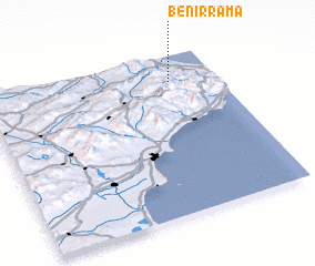 Places with similar names to Benirrama, Spain ::
// Ben Rami (MA)
// Ban Nai Ram (TH)
// Ban Niramai (TH)
// Ban Ram (TH)
// Ban Ram (TH)
// Ban Rom (TH)
// Banerema (TP)
// Banoram (NG)
// Ban Ramay (LA)
// Bene Reʼem (IL)
Disclaimer :: Information on this page comes without warranty of any kind |
||
|
Where is Benirrama? Elevation and coordinates ::
Latitude (lat): 38°50'0"N Longitude (lon): 0°12'0"W
Elevation (approx.): 242m (map arrows pan, magnifying glasses zoom) |
||
|
Visiting Benirrama? Hotel/Accommodation ::
Book a hotel in Benirrama Travel Guide ::
Buy a travel guide for Spain rental cars ::
car rental offers GPS waypoint ::
download a GPX waypoint (PoI) of Benirrama for your GPS receiver
|
||