|
search place name
|
||
Ban Nam Song (Udon Thani, Thailand)Ban Nam Song is a town in the Udon Thani region of Thailand. An overview map of the region around Ban Nam Song is displayed below.
regional and 3d topo map of Ban Nam Song, Thailand ::

Ban Nam Song airports ::
The nearest airport is VTE - Vientiane Wattay Intl, located 50.8 km north east of Ban Nam Song.
Other airports nearby include LOE - Loei (57.5 km south west), UTH - Udon Thani (79.9 km south east), PRH - Phrae (213.8 km west), SNO - Sakon Nakhon (218.7 km east), Nearby towns ::
Ban Na Chan (3.5km east) //
Amphoe Nam Som (4.8km east) //
Ban Kong (6.9km north west) //
Ban Huai Saet (7.2km west) //
Ban Yuak (9.0km south) //
Ban Hua Chang (9.8km north east) //
[all distances 'as the bird flies' and approximate] 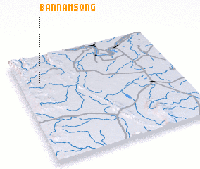 Places with similar names to Ban Nam Song, Thailand ::
// Ban Mae Sa-nga (TH)
// Ban Mae Sanga (TH)
// Ban Mae Sing (TH)
// Ban Mae Song (TH)
// Ban Nam Sang (TH)
// Ban Nam Sing (TH)
// Ban Nam Song (TH)
// Ban Nam Song (TH)
// Ban Om Sing (TH)
// Ban Maisoung (LA)
Disclaimer :: Information on this page comes without warranty of any kind |
||
|
Where is Ban Nam Song? Elevation and coordinates ::
Latitude (lat): 17°45'44"N Longitude (lon): 102°8'45"E
Elevation (approx.): 227m (map arrows pan, magnifying glasses zoom) |
||
|
Visiting Ban Nam Song? Hotel/Accommodation ::
Book a hotel in Ban Nam Song Travel Guide ::
Buy a travel guide for Thailand rental cars ::
car rental offers GPS waypoint ::
download a GPX waypoint (PoI) of Ban Nam Song for your GPS receiver
|
||