|
search place name
|
||
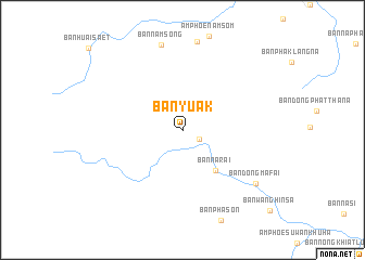
Ban Yuak (Udon Thani, Thailand)Ban Yuak is a town in the Udon Thani region of Thailand. An overview map of the region around Ban Yuak is displayed below.
regional and 3d topo map of Ban Yuak, Thailand ::
Ban Yuak airports ::
The nearest airport is VTE - Vientiane Wattay Intl, located 54.0 km north east of Ban Yuak.
Other airports nearby include LOE - Loei (54.3 km south west), UTH - Udon Thani (73.8 km south east), SNO - Sakon Nakhon (214.4 km east), PHS - Phitsanulok (224.0 km south west), Nearby towns ::
Ban Tha Li (1.9km south east) //
Ban Na Rai (5.3km south east) //
Ban Nam Song (9.0km north) //
Ban Dong Mafai (9.1km south east) //
[all distances 'as the bird flies' and approximate]  Places with similar names to Ban Yuak, Thailand ::
// Banyago (PH)
// Ban Na Yaek (TH)
// Ban Yai (2) (TH)
// Ban Yuak (TH)
// Ban Yu Ki (TH)
// Banī Yak (IR)
// Banī Yekkeh (IR)
// Banī Yekkeh (IR)
// Bīn Yekī (IR)
// Boneh-ye Kā (IR)
Disclaimer :: Information on this page comes without warranty of any kind |
||
|
Where is Ban Yuak? Elevation and coordinates ::
Latitude (lat): 17°40'59"N Longitude (lon): 102°9'56"E
Elevation (approx.): 233m (map arrows pan, magnifying glasses zoom) |
||
|
Visiting Ban Yuak? Hotel/Accommodation ::
Book a hotel in Ban Yuak Travel Guide ::
Buy a travel guide for Thailand rental cars ::
car rental offers GPS waypoint ::
download a GPX waypoint (PoI) of Ban Yuak for your GPS receiver
|
||