|
search place name
|
||
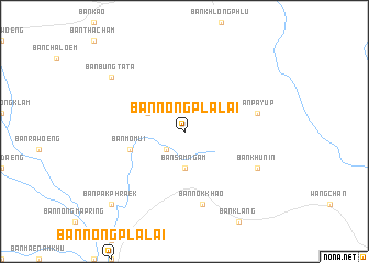
Ban Nong Pla Lai (Rayong, Thailand)Ban Nong Pla Lai is a town in the Rayong region of Thailand. An overview map of the region around Ban Nong Pla Lai is displayed below.
regional and 3d topo map of Ban Nong Pla Lai, Thailand ::
Ban Nong Pla Lai airports ::
The nearest airport is UTP - Rayong U Taphao Intl, located 54.2 km south west of Ban Nong Pla Lai.
Other airports nearby include BKK - Bangkok Intl (131.4 km north west), HHQ - Prachuap Khiri Khan Hua Hin (160.6 km west), NAK - Nakhon Ratchasima Khorat (226.8 km north), Nearby towns ::
Ban Nong Kho (2.6km south west) //
Ban Sam Ngam (3.7km south) //
Ban Nong Lam Daeng (3.7km south) //
Ban Nong Khla (4.1km north west) //
Ban Ma Mui (5.7km west) //
Ban Mo Mui (5.7km west) //
Ban Pa Yup (7.5km east) //
Ban Nok Khao (7.6km south) //
Ban Khun In (8.1km south east) //
Ban Bung Ta Ta (9.1km north west) //
Ban Pak Phraek (10.4km south west) //
[all distances 'as the bird flies' and approximate]  Places with similar names to Ban Nong Pla Lai, Thailand ::
// Ban Nong Pla Lai (TH)
// Ban Nong Pla Lai (TH)
// Ban Nong Pla Lai (TH)
// Ban Nong Pla Lai (TH)
// Ban Nong Pla Lai (TH)
// Ban Nong Pla Lai (TH)
// Ban Nong Pla Lai (TH)
// Ban Nong Pla Lai (TH)
// Ban Nong Pla Lai (TH)
// Ban Nong Pla Lai (TH)
Disclaimer :: Information on this page comes without warranty of any kind |
||
|
Where is Ban Nong Pla Lai? Elevation and coordinates ::
Latitude (lat): 13°0'0"N Longitude (lon): 101°23'0"E
Elevation (approx.): 85m (map arrows pan, magnifying glasses zoom) |
||
|
Visiting Ban Nong Pla Lai? Hotel/Accommodation ::
Book a hotel in Ban Nong Pla Lai Travel Guide ::
Buy a travel guide for Thailand rental cars ::
car rental offers GPS waypoint ::
download a GPX waypoint (PoI) of Ban Nong Pla Lai for your GPS receiver
|
||