|
search place name
|
||
Ban Nong Waeng (Nong Khai, Thailand)Ban Nong Waeng is a town in the Nong Khai region of Thailand. An overview map of the region around Ban Nong Waeng is displayed below.
regional and 3d topo map of Ban Nong Waeng, Thailand ::

Ban Nong Waeng airports ::
The nearest airport is VTE - Vientiane Wattay Intl, located 118.6 km west of Ban Nong Waeng.
Other airports nearby include UTH - Udon Thani (141.2 km south west), SNO - Sakon Nakhon (144.1 km south), LPQ - Luang Prabang Luang Phabang Intl (224.6 km north west), LOE - Loei (225.5 km south west), Nearby towns ::
Ban Kouay (0.2km north east) //
Ban Hin Lat (0.2km north east) //
Ban Na Kok (1.7km west) //
Bung Kan (2.5km south east) //
Ban Na Pan (4.0km south east) //
Ban Nong Veung (4.0km north west) //
Ban Huai Suam (5.6km west) //
Ban Nong Na Saeng (6.6km south) //
Muang Pakxan (6.4km south east) //
Ban Katoy (6.6km north east) //
Ban Tung (6.6km north east) //
Ban Nampa (6.8km north east) //
Bung Kan (6.6km south east) //
Ban Si Wi Lai (7.1km east) //
Ban Fang Daeng (7.5km south east) //
Ban Songkhon (1) (7.8km north east) //
Ban Hangxing (7.9km north west) //
[all distances 'as the bird flies' and approximate] 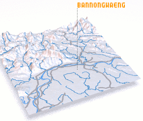 Places with similar names to Ban Nong Waeng, Thailand ::
// Ban Nong Waeng (TH)
// Ban Nong Waeng (TH)
// Ban Nong Waeng (TH)
// Ban Nong Waeng (TH)
// Ban Nong Waeng (TH)
// Ban Nong Waeng (TH)
// Ban Nong Waeng (TH)
// Ban Nong Waeng (TH)
// Ban Nong Waeng (TH)
// Ban Nong Waeng (TH)
Disclaimer :: Information on this page comes without warranty of any kind |
||
|
Where is Ban Nong Waeng? Elevation and coordinates ::
Latitude (lat): 18°23'55"N Longitude (lon): 103°35'57"E
Elevation (approx.): 163m (map arrows pan, magnifying glasses zoom) |
||
|
Visiting Ban Nong Waeng? Hotel/Accommodation ::
Book a hotel in Ban Nong Waeng Travel Guide ::
Buy a travel guide for Thailand rental cars ::
car rental offers GPS waypoint ::
download a GPX waypoint (PoI) of Ban Nong Waeng for your GPS receiver
|
||