|
search place name
|
||
Ban Kouay (Laos)Ban Kouay is a town in Laos. An overview map of the region around Ban Kouay is displayed below.
regional and 3d topo map of Ban Kouay, Laos ::

Ban Kouay airports ::
The nearest airport is VTE - Vientiane Wattay Intl, located 118.8 km south west of Ban Kouay.
Other airports nearby include UTH - Udon Thani (141.4 km south west), SNO - Sakon Nakhon (144.2 km south), LPQ - Luang Prabang Luang Phabang Intl (224.5 km north west), LOE - Loei (225.6 km south west), Nearby towns ::
Ban Hin Lat (0.0km north) //
Ban Nong Waeng (0.2km south west) //
Ban Na Kok (1.8km west) //
Bung Kan (2.6km south east) //
Ban Nong Veung (4.0km north west) //
Ban Na Pan (4.1km south east) //
Ban Huai Suam (5.6km west) //
Ban Nampa (6.6km north east) //
Muang Pakxan (6.4km south east) //
Ban Katoy (6.4km north east) //
Ban Tung (6.4km north east) //
Ban Nong Na Saeng (6.7km south) //
Bung Kan (6.7km south east) //
Ban Si Wi Lai (7.0km east) //
Ban Fang Daeng (7.6km south east) //
Ban Songkhon (1) (7.7km north east) //
Ban Hangxing (8.0km north west) //
[all distances 'as the bird flies' and approximate] 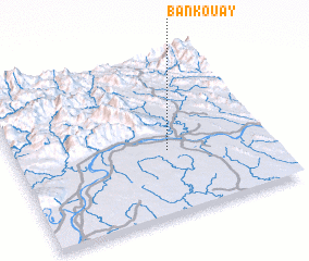 Places with similar names to Ban Kouay, Laos ::
Disclaimer :: Information on this page comes without warranty of any kind |
||
|
Where is Ban Kouay? Elevation and coordinates ::
Latitude (lat): 18°24'0"N Longitude (lon): 103°36'0"E
Elevation (approx.): 161m (map arrows pan, magnifying glasses zoom) |
||
|
Visiting Ban Kouay? Hotel/Accommodation ::
Book a hotel in Ban Kouay Travel Guide ::
Buy a travel guide for Laos rental cars ::
car rental offers GPS waypoint ::
download a GPX waypoint (PoI) of Ban Kouay for your GPS receiver
|
||