|
search place name
|
||
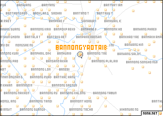
Ban Nong Yao Tai (1) (Sara Buri, Thailand)Ban Nong Yao Tai (1) is a town in the Sara Buri region of Thailand. An overview map of the region around Ban Nong Yao Tai (1) is displayed below.
regional and 3d topo map of Ban Nong Yao Tai (1), Thailand ::
Ban Nong Yao Tai (1) airports ::
The nearest airport is BKK - Bangkok Intl, located 69.0 km south west of Ban Nong Yao Tai (1).
Other airports nearby include NAK - Nakhon Ratchasima Khorat (137.1 km east), UTP - Rayong U Taphao Intl (198.0 km south), HHQ - Prachuap Khiri Khan Hua Hin (227.0 km south west), Nearby towns ::
Ban Phu Lao (1.8km east) //
Ban Nong Khrok (1.9km south) //
Ban Nong Ta Phrom (1.9km south) //
Ban Nong Khuan Chang (1) (1.8km west) //
Ban Pa Phai (1.8km west) //
Ban Nong Yao Nua (2.6km north east) //
Ban Makham Yong (2.6km south west) //
Ban Nong Tae (3.6km east) //
Ban Huai (1) (3.6km west) //
Ban Nong Nak (3.7km south) //
Ban Phlap (2) (4.0km north east) //
Ban Nong No Tai (1) (4.0km north west) //
Ban Pak Khao San (4.1km north east) //
Ban Nong Pru (1) (4.1km north west) //
Ban Don Dua (4.0km south west) //
Ban Huai Thong Lang (4.1km south west) //
Ban Choeng Khao (5.2km north east) //
Ban Rai (5.2km south west) //
Ban Huai Sai (1) (5.6km south) //
Ban Khok Sawang (1) (5.6km north) //
Ban Nong Sam Raet (1) (5.4km west) //
Ban Sai Mun (1) (5.7km east) //
Ban Nong Ton (1) (5.7km west) //
Ban Phae (1) (5.8km north) //
Ban Nong Pla Lai (1) (5.7km east) //
Ban Huai Khamin (5.8km south) //
Ban Khok Kathin (5.8km south) //
Ban San Makha (5.7km west) //
Ban Tha Chang (6.6km south west) //
[all distances 'as the bird flies' and approximate] 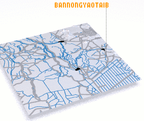 Places with similar names to Ban Nong Yao Tai (1), Thailand :: Disclaimer :: Information on this page comes without warranty of any kind |
||
|
Where is Ban Nong Yao Tai (1)? Elevation and coordinates ::
Latitude (lat): 14°28'0"N Longitude (lon): 100°54'0"E
Elevation (approx.): 19m (map arrows pan, magnifying glasses zoom) |
||
|
Visiting Ban Nong Yao Tai (1)? Hotel/Accommodation ::
Book a hotel in Ban Nong Yao Tai (1) Travel Guide ::
Buy a travel guide for Thailand rental cars ::
car rental offers GPS waypoint ::
download a GPX waypoint (PoI) of Ban Nong Yao Tai (1) for your GPS receiver
|
||