|
search place name
|
||
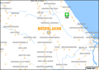
Ban Pa Lu Kha (Narathiwat, Thailand)Ban Pa Lu Kha is a town in the Narathiwat region of Thailand. An overview map of the region around Ban Pa Lu Kha is displayed below.
regional and 3d topo map of Ban Pa Lu Kha, Thailand ::
Ban Pa Lu Kha airports ::
The nearest airport is NAW - Narathiwat, located 10.2 km north east of Ban Pa Lu Kha.
Other airports nearby include PAN - Pattani (69.3 km north west), KBR - Kota Bahru Sultan Ismail Petra (74.4 km south east), AOR - Alor Setar Sultan Abdul Halim (145.1 km west), HDY - Songkhla Hat Yai Intl (152.3 km west), Nearby towns ::
Kampong Baluka (0.0km north) //
Ban Bu Ke Ba Kong (1.1km north) //
Kampong Poyo (1.9km north) //
Kampong Kubang Bado (1.9km south) //
Kampong Dalokuwing (1.8km east) //
Ban Ku Wae (2.4km west) //
Ban Bu Nae (2.6km north west) //
Kampong Lubo Sawo (3.7km north) //
Ban Talo Kuwing (4.0km south east) //
Ban Ku Bae Ba Do (4.1km south west) //
Ban Sungai Batu (4.3km north west) //
Ban Lu Bo Ba Ya (5.0km south) //
Kampong Lubobusa (5.2km south east) //
Kampong Dangapo (5.9km south) //
Kampong Sateng (5.9km north) //
Ban Khok Khian (5.9km south) //
Ban Hu Tae Yu Lo (6.0km north east) //
Yingo (6.2km south east) //
Kampong Lapa (7.6km west) //
Kampong Lukku (7.6km north) //
Kampong Tayong (7.6km south) //
Ban Tan Yong (7.7km west) //
Ban Lahan (7.8km south east) //
Ba Cho (8.4km north west) //
Ban Bu Re (8.5km north) //
Ban Khok Mai Phai (9.2km south east) //
Ban Hu Tae Thu Wo (10.9km north east) //
[all distances 'as the bird flies' and approximate]  Places with similar names to Ban Pa Lu Kha, Thailand ::
// Ban Pilok Khi (TH)
// Ban Pilok Khi (TH)
// Ban Pla Khao (TH)
// Ban Pla Khao (TH)
// Ban Pla Khao (TH)
// Ban Pla Khao (TH)
// Ban Pla Khao (TH)
Disclaimer :: Information on this page comes without warranty of any kind |
||
|
Where is Ban Pa Lu Kha? Elevation and coordinates ::
Latitude (lat): 6°27'0"N Longitude (lon): 101°41'0"E
Elevation (approx.): 16m (map arrows pan, magnifying glasses zoom) |
||
|
Visiting Ban Pa Lu Kha? Hotel/Accommodation ::
Book a hotel in Ban Pa Lu Kha Travel Guide ::
Buy a travel guide for Thailand rental cars ::
car rental offers GPS waypoint ::
download a GPX waypoint (PoI) of Ban Pa Lu Kha for your GPS receiver
|
||