|
search place name
|
||
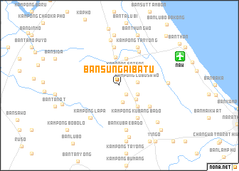
Ban Sungai Batu (Narathiwat, Thailand)Ban Sungai Batu is a town in the Narathiwat region of Thailand. An overview map of the region around Ban Sungai Batu is displayed below.
regional and 3d topo map of Ban Sungai Batu, Thailand ::
Ban Sungai Batu airports ::
The nearest airport is NAW - Narathiwat, located 10.5 km north east of Ban Sungai Batu.
Other airports nearby include PAN - Pattani (65.2 km north west), KBR - Kota Bahru Sultan Ismail Petra (78.3 km south east), AOR - Alor Setar Sultan Abdul Halim (143.0 km west), HDY - Songkhla Hat Yai Intl (148.6 km west), Nearby towns ::
Ban Bu Nae (1.7km south east) //
Kampong Sateng (2.5km north east) //
Ban Ku Wae (2.7km south) //
Kampong Lubo Sawo (2.9km east) //
Kampong Poyo (3.2km south east) //
Ban Bu Ke Ba Kong (3.3km south east) //
Kampong Lukku (4.3km north) //
Ban Pa Lu Kha (4.3km south east) //
Kampong Baluka (4.3km south east) //
Ba Cho (4.5km north) //
Kampong Dalokuwing (5.7km south east) //
Kampong Kubang Bado (5.8km south east) //
Ban Bu Re (6.1km north) //
Ban Bu Re (6.1km north east) //
Kampong Tanyong (6.7km north east) //
Kampong Lapa (6.8km south west) //
Ban Tan Yong (6.9km south west) //
Ban Ku Bae Ba Do (7.0km south) //
Ban Ka Yo Ma Ti (7.3km north) //
Ban Hu Tae Yu Lo (7.6km east) //
Ban Chang Tai (7.9km north) //
Ban Lu Bo Ba Ya (8.2km south) //
Ban Talo Kuwing (8.3km south east) //
Ban Thung Wo (8.4km north) //
Kampong Dangapo (8.9km south) //
Ban Ya Lu Tong (9.0km north) //
Kampong Lubobusa (9.5km south east) //
Ban Khok Khian (10.0km south east) //
Yingo (10.4km south east) //
[all distances 'as the bird flies' and approximate] 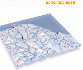 Places with similar names to Ban Sungai Batu, Thailand :: Disclaimer :: Information on this page comes without warranty of any kind |
||
|
Where is Ban Sungai Batu? Elevation and coordinates ::
Latitude (lat): 6°28'45"N Longitude (lon): 101°39'27"E
Elevation (approx.): 29m (map arrows pan, magnifying glasses zoom) |
||
|
Visiting Ban Sungai Batu? Hotel/Accommodation ::
Book a hotel in Ban Sungai Batu Travel Guide ::
Buy a travel guide for Thailand rental cars ::
car rental offers GPS waypoint ::
download a GPX waypoint (PoI) of Ban Sungai Batu for your GPS receiver
|
||