|
search place name
|
||
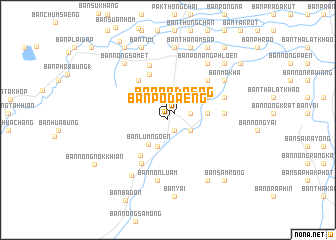
Ban Po Daeng (Nakhon Ratchasima, Thailand)Ban Po Daeng is a town in the Nakhon Ratchasima region of Thailand. An overview map of the region around Ban Po Daeng is displayed below.
regional and 3d topo map of Ban Po Daeng, Thailand ::
Ban Po Daeng airports ::
The nearest airport is NAK - Nakhon Ratchasima Khorat, located 36.6 km north of Ban Po Daeng.
Other airports nearby include BKK - Bangkok Intl (170.0 km south west), REP - Siem-reap Siem Reap (235.7 km south east), UTP - Rayong U Taphao Intl (239.7 km south west), Nearby towns ::
Ban Po Daeng (1.0km north east) //
Ban Khlong Toei (1.3km south east) //
Ban Kao (2.6km east) //
Ban Kok (2.7km north) //
Ban Nong Phai (2.7km north) //
Ban Lum Khao (2.7km north) //
Ban Nong Tabaek (2.7km north) //
Ban Huai Sakae Rat (2.7km south east) //
Ban Kut Ta Rang (3.2km south) //
Ban Nong Kok (3.4km north west) //
Ban Lum Ngoen (3.5km south west) //
Ban Prong (3.6km north east) //
Ban Nong Faep (4.3km east) //
Ban Non Daeng (5.0km south west) //
Ban Khi Lek (5.0km north east) //
Ban Nong Pru (5.4km north west) //
Ban Nong Phai (2) (5.5km north) //
Ban Kham Choi (5.7km south west) //
Ban Don Mafuang (6.1km north east) //
Ban Khok Nong Faep (6.1km east) //
Ban Nong Khon (6.4km north) //
Ban Nong Tabaek (6.6km north east) //
Ban Non Luam (6.8km south) //
Ban Ba Yai (7.3km south west) //
Ban Khok (7.6km north east) //
Ban Khok Nang Phloen (7.6km north east) //
Ban Po Nang Phloen (7.6km north east) //
Ban Makha (7.5km north east) //
Ban Nong Samet (7.8km north west) //
[all distances 'as the bird flies' and approximate]  Places with similar names to Ban Po Daeng, Thailand ::
// Ban Pa Daeng (TH)
// Ban Pa Daeng (TH)
// Ban Pa Daeng (TH)
// Ban Pa Daeng (TH)
// Ban Pa Daeng (TH)
// Ban Pa Daeng (TH)
// Ban Pa Daeng (TH)
// Ban Pa Daeng (TH)
// Ban Pa Daeng (TH)
// Ban Pa Daeng (TH)
Disclaimer :: Information on this page comes without warranty of any kind |
||
|
Where is Ban Po Daeng? Elevation and coordinates ::
Latitude (lat): 14°36'37"N Longitude (lon): 102°0'37"E
Elevation (approx.): 219m (map arrows pan, magnifying glasses zoom) |
||
|
Visiting Ban Po Daeng? Hotel/Accommodation ::
Book a hotel in Ban Po Daeng Travel Guide ::
Buy a travel guide for Thailand rental cars ::
car rental offers GPS waypoint ::
download a GPX waypoint (PoI) of Ban Po Daeng for your GPS receiver
|
||