|
search place name
|
||
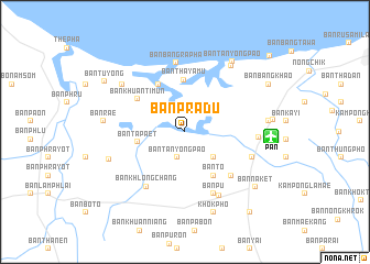
Ban Pradu (Pattani, Thailand)Ban Pradu is a town in the Pattani region of Thailand. An overview map of the region around Ban Pradu is displayed below.
regional and 3d topo map of Ban Pradu, Thailand ::
Ban Pradu airports ::
The nearest airport is PAN - Pattani, located 8.8 km east of Ban Pradu.
Other airports nearby include HDY - Songkhla Hat Yai Intl (76.9 km west), NAW - Narathiwat (79.8 km east), AOR - Alor Setar Sultan Abdul Halim (100.0 km south west), KBR - Kota Bahru Sultan Ismail Petra (151.4 km south east), Nearby towns ::
Ban Don Yang (2.7km south) //
Ban Tanyong Pao (2.7km south) //
Ban Khuan Khu Ha (3.7km north east) //
Ban Chang (3.9km south east) //
Ban Ta Paet (4.9km west) //
Ban Tha Ya Mu (5.3km north) //
Ban To (5.3km south east) //
Ban Tha Ya Mu (5.5km north west) //
Ban Khuan Ti Mun (5.8km north west) //
Ban Makrut (6.5km south east) //
Ban Khlong Chang (6.8km south west) //
Ban Pu (6.9km south east) //
Ban Bang Ra Pha (7.0km north) //
Ban Chamao (7.3km east) //
Khok Pho (7.4km south east) //
Ban Bo Thong (7.5km east) //
Ban Tuyong (8.0km north west) //
Ban Nikhom Sang Ton Eng Thepha (8.1km west) //
Ban Khok Khlop (8.2km north east) //
Ban Rae (8.3km west) //
Ban Bo Met Chun (8.4km east) //
Ban Tan Yong Pao (8.6km north east) //
Ban Pho (8.6km south) //
Khok Pho (8.6km south) //
Ban Na Ket (9.0km south east) //
Ban Tu Yong (9.5km north west) //
Ban Bang Khao (9.7km north east) //
Ban Yang Daeng (10.4km south east) //
Ban Ba Ing (11.5km north east) //
[all distances 'as the bird flies' and approximate] 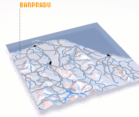 Places with similar names to Ban Pradu, Thailand ::
// Bonaparte (US)
// Ban Ao Pradu (TH)
// Ban Na Pradu (TH)
// Ban Pa Raet (TH)
// Ban Pradao (TH)
// Ban Prado (TH)
// Ban Pradu (TH)
// Ban Pradu (TH)
// Ban Pradu (TH)
// Ban Pradu (TH)
Disclaimer :: Information on this page comes without warranty of any kind |
||
|
Where is Ban Pradu? Elevation and coordinates ::
Latitude (lat): 6°47'24"N Longitude (lon): 101°4'27"E
Elevation (approx.): 18m (map arrows pan, magnifying glasses zoom) |
||
|
Visiting Ban Pradu? Hotel/Accommodation ::
Book a hotel in Ban Pradu Travel Guide ::
Buy a travel guide for Thailand rental cars ::
car rental offers GPS waypoint ::
download a GPX waypoint (PoI) of Ban Pradu for your GPS receiver
|
||