|
search place name
|
||
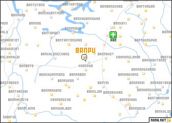
Ban Pu (Pattani, Thailand)Ban Pu is a town in the Pattani region of Thailand. An overview map of the region around Ban Pu is displayed below.
regional and 3d topo map of Ban Pu, Thailand ::
Ban Pu airports ::
The nearest airport is PAN - Pattani, located 8.3 km north east of Ban Pu.
Other airports nearby include NAW - Narathiwat (75.0 km east), HDY - Songkhla Hat Yai Intl (81.2 km west), AOR - Alor Setar Sultan Abdul Halim (98.2 km south west), KBR - Kota Bahru Sultan Ismail Petra (146.1 km south east), Nearby towns ::
Khok Pho (0.6km east) //
Ban Pho (1.9km south) //
Khok Pho (1.9km south) //
Ban To (1.9km north) //
Ban Makrut (2.6km north east) //
Ban Chang (3.7km north) //
Ban Yang Daeng (4.1km south east) //
Ban Pa Bon (4.1km south west) //
Ban Na Ket (4.3km east) //
Ban Don Yang (5.2km north west) //
Ban Tanyong Pao (5.2km north west) //
Ban Chamao (5.4km north east) //
Ban Khok Ko (5.7km south) //
Amphoe Khok Pho (6.7km south west) //
Ban Chang Ha (6.7km south west) //
Ban Khuan Tha Rua (6.7km south west) //
Ban Yai (6.7km south east) //
Ban Pu Ron (6.7km south west) //
Ban Khlong Chang (6.7km west) //
Ban Pradu (6.9km north west) //
Ban Bo Thong (7.4km north east) //
Ban Chang Hai (7.6km south) //
Ban Kluai (7.6km south) //
Ban Lam Din Niao (8.3km south) //
Ban Khuan Niang (8.2km south west) //
Amphoe Nong Chik (8.2km north east) //
Ban Bang Tawa (8.2km north east) //
Changwat Pattani (8.2km north east) //
Ban Khuan Khu Ha (8.4km north) //
[all distances 'as the bird flies' and approximate]  Places with similar names to Ban Pu, Thailand ::
// Ban I Poei (TH)
// Ban Na I Poei (TH)
// Ban Na Pa (TH)
// Ban Na Pa (TH)
// Ban Na Pa (TH)
// Ban Na Pa (TH)
// Ban Na Pa (TH)
// Ban Na Pu (TH)
// Ban Na Pu (TH)
// Ban Nop (TH)
Disclaimer :: Information on this page comes without warranty of any kind |
||
|
Where is Ban Pu? Elevation and coordinates ::
Latitude (lat): 6°44'0"N Longitude (lon): 101°6'0"E
Elevation (approx.): 30m (map arrows pan, magnifying glasses zoom) |
||
|
Visiting Ban Pu? Hotel/Accommodation ::
Book a hotel in Ban Pu Travel Guide ::
Buy a travel guide for Thailand rental cars ::
car rental offers GPS waypoint ::
download a GPX waypoint (PoI) of Ban Pu for your GPS receiver
|
||