|
search place name
|
||
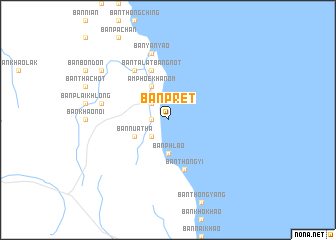
Ban Pret (Nakhon Si Thammarat, Thailand)Ban Pret is a town in the Nakhon Si Thammarat region of Thailand. An overview map of the region around Ban Pret is displayed below.
regional and 3d topo map of Ban Pret, Thailand ::
Ban Pret airports ::
The nearest airport is NST - Nakhon Si Thammarat Cha Ian, located 77.3 km south of Ban Pret.
Other airports nearby include TST - Trang (185.7 km south), HKT - Phuket Intl (208.1 km south west), Nearby towns ::
Ban Thung O (1.8km west) //
Ban Phang Phrao (2.6km north west) //
Ban Na Dan (2.6km south west) //
Ban Phlao (3.7km south) //
Amphoe Khanom (4.1km north west) //
Ban Nua Tha (4.1km south west) //
Ban Talat Bang Not (5.9km north) //
Ban Thong Yi (5.9km south) //
Ban Phaeng (6.7km north west) //
Ban Yan Yao (7.6km north) //
Ban Nua (7.5km west) //
Ban Bang Khu (9.2km north west) //
[all distances 'as the bird flies' and approximate] 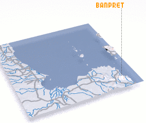 Places with similar names to Ban Pret, Thailand ::
// Bonaparte (US)
// Ban Ao Pradu (TH)
// Ban Na Pradu (TH)
// Ban Pa Raet (TH)
// Ban Pradao (TH)
// Ban Prado (TH)
// Ban Pradu (TH)
// Ban Pradu (TH)
// Ban Pradu (TH)
// Ban Pradu (TH)
Disclaimer :: Information on this page comes without warranty of any kind |
||
|
Where is Ban Pret? Elevation and coordinates ::
Latitude (lat): 9°10'0"N Longitude (lon): 99°53'0"E
Elevation (approx.): -32768m (map arrows pan, magnifying glasses zoom) |
||
|
Visiting Ban Pret? Hotel/Accommodation ::
Book a hotel in Ban Pret Travel Guide ::
Buy a travel guide for Thailand rental cars ::
car rental offers GPS waypoint ::
download a GPX waypoint (PoI) of Ban Pret for your GPS receiver
|
||