|
search place name
|
||
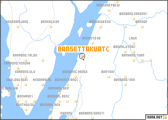
Ban Set Takuat (2) (Ranong, Thailand)Ban Set Takuat (2) is a town in the Ranong region of Thailand. An overview map of the region around Ban Set Takuat (2) is displayed below.
regional and 3d topo map of Ban Set Takuat (2), Thailand ::
Ban Set Takuat (2) airports ::
The nearest airport is HKT - Phuket Intl, located 221.3 km south of Ban Set Takuat (2).
Other airports nearby include NST - Nakhon Si Thammarat Cha Ian (227.7 km south east), Nearby towns ::
Ban Hin Dat (2.6km north east) //
Bang Hin Chang (1) (4.1km south west) //
Ban Ao Ton (1) (4.1km north east) //
Ban Yai (1) (6.6km south east) //
Ban Hin Chang (2) (6.7km south west) //
Ban Sai Daeng (8.3km north east) //
Ban Sam Laem (9.2km south west) //
Bankachon (10.4km north west) //
[all distances 'as the bird flies' and approximate] 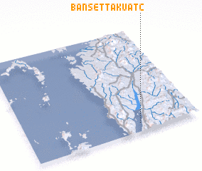 Places with similar names to Ban Set Takuat (2), Thailand :: Disclaimer :: Information on this page comes without warranty of any kind |
||
|
Where is Ban Set Takuat (2)? Elevation and coordinates ::
Latitude (lat): 10°5'0"N Longitude (lon): 98°40'0"E
Elevation (approx.): 10m (map arrows pan, magnifying glasses zoom) |
||
|
Visiting Ban Set Takuat (2)? Hotel/Accommodation ::
Book a hotel in Ban Set Takuat (2) Travel Guide ::
Buy a travel guide for Thailand rental cars ::
car rental offers GPS waypoint ::
download a GPX waypoint (PoI) of Ban Set Takuat (2) for your GPS receiver
|
||