|
search place name
|
||
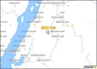
Ban Yai (1) (Ranong, Thailand)Ban Yai (1) is a town in the Ranong region of Thailand. An overview map of the region around Ban Yai (1) is displayed below.
regional and 3d topo map of Ban Yai (1), Thailand ::
Ban Yai (1) airports ::
The nearest airport is HKT - Phuket Intl, located 218.7 km south of Ban Yai (1).
Other airports nearby include NST - Nakhon Si Thammarat Cha Ian (221.4 km south east), Nearby towns ::
Ban Khok Chang (3.6km east) //
Ban Bang Yai (1) (4.1km south east) //
Ban Phlu Kha (2) (6.7km north east) //
Ban Wang Yuan (6.6km north east) //
Ban Set Takuat (2) (6.6km north west) //
Ban Hin Dat (6.7km north west) //
Bang Hin Chang (1) (7.3km west) //
Ban Na Yao (7.8km north east) //
Ban Bang Kae (7.8km north east) //
Ban Bang Sang Tong (8.2km north east) //
Ban Wang Lum (8.2km north east) //
Ban Ao Ton (1) (8.3km north west) //
Ban Bang Kaen Chan (9.2km north east) //
Laun (9.2km north east) //
Ban Bang Non Nai (5) (9.2km south west) //
Ban Bang Non Nai (9.2km south west) //
[all distances 'as the bird flies' and approximate] 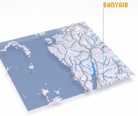 Places with similar names to Ban Yai (1), Thailand ::
// Ban Na Yao (1) (TH)
// Ban Na Yao (1) (TH)
// Ban Yai (1) (TH)
// Banyāb (IR)
// Buôn Yĕ (1) (VN)
Disclaimer :: Information on this page comes without warranty of any kind |
||
|
Where is Ban Yai (1)? Elevation and coordinates ::
Latitude (lat): 10°3'0"N Longitude (lon): 98°43'0"E
Elevation (approx.): 136m (map arrows pan, magnifying glasses zoom) |
||
|
Visiting Ban Yai (1)? Hotel/Accommodation ::
Book a hotel in Ban Yai (1) Travel Guide ::
Buy a travel guide for Thailand rental cars ::
car rental offers GPS waypoint ::
download a GPX waypoint (PoI) of Ban Yai (1) for your GPS receiver
|
||