|
search place name
|
||
Ban Thai Thung (Phichit, Thailand)Ban Thai Thung is a town in the Phichit region of Thailand. An overview map of the region around Ban Thai Thung is displayed below.
regional and 3d topo map of Ban Thai Thung, Thailand ::

Ban Thai Thung airports ::
The nearest airport is PHS - Phitsanulok, located 74.5 km north of Ban Thai Thung.
Other airports nearby include LOE - Loei (192.0 km north east), NAK - Nakhon Ratchasima Khorat (214.9 km south east), PRH - Phrae (222.5 km north), Nearby towns ::
Ban Thung Pho (1.8km west) //
Ban Dong Takhop (3.6km west) //
Ban Wang Lum (4.1km north west) //
Ban Khlong Wang (4.0km south west) //
Thap Khlo (5.7km east) //
Ban Lat Luang (7.4km west) //
Ban Nong Sadao (7.7km south west) //
Ban Huai Choi (7.7km north west) //
Ban Khlong Na (2) (8.0km south west) //
Ban Khao Ruak (8.2km north west) //
Ban Lam Prada Tai (1) (9.1km south west) //
Ban Khao Sai (10.3km south east) //
[all distances 'as the bird flies' and approximate] 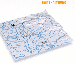 Places with similar names to Ban Thai Thung, Thailand ::
// Ban Tha Thong (TH)
// Ban Tha Thong (TH)
// Ban Tha Thong (TH)
// Ban Uthai Thong (TH)
// Bản Thay Thượng (VN)
Disclaimer :: Information on this page comes without warranty of any kind |
||
|
Where is Ban Thai Thung? Elevation and coordinates ::
Latitude (lat): 16°9'0"N Longitude (lon): 100°31'0"E
Elevation (approx.): 35m (map arrows pan, magnifying glasses zoom) |
||
|
Visiting Ban Thai Thung? Hotel/Accommodation ::
Book a hotel in Ban Thai Thung Travel Guide ::
Buy a travel guide for Thailand rental cars ::
car rental offers GPS waypoint ::
download a GPX waypoint (PoI) of Ban Thai Thung for your GPS receiver
|
||