|
search place name
|
||
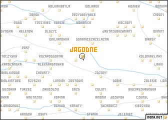
Jagodne (Poland)Jagodne is a town in Poland. An overview map of the region around Jagodne is displayed below.
regional and 3d topo map of Jagodne, Poland ::
Jagodne airports ::
The nearest airport is WAW - Warsaw Okecie, located 85.8 km west of Jagodne.
Other airports nearby include RZE - Rzeszow Jasionka (208.7 km south), Nearby towns ::
Warkocz (1.1km west) //
Domanice Zażelazna (3.9km north) //
Żdżary (4.4km south east) //
Zastawie (5.7km south) //
Wólka Zastawska (5.7km south) //
Piaski (6.0km south) //
Emilianówka (5.0km north west) //
Róża Podgórna (4.6km west) //
Domanice (7.4km north) //
Gózd (7.5km south) //
Aleksandrówka (4.9km west) //
Lipniak (6.5km south west) //
Czachy (6.5km north west) //
Celiny (7.8km south) //
Jedlanka (7.2km south west) //
Olszyc (7.2km north west) //
Dąbie (7.2km south east) //
Kopcie (8.2km north west) //
Jastrzębie Smiary (7.2km north east) //
Jastrzębie Mroczki (7.2km north east) //
Zagoździe (8.7km south west) //
Jastrzębie (8.7km north east) //
Jastrzębie Lupiny (8.7km north east) //
[all distances 'as the bird flies' and approximate]  Places with similar names to Jagodne, Poland ::
Disclaimer :: Information on this page comes without warranty of any kind |
||
|
Where is Jagodne? Elevation and coordinates ::
Latitude (lat): 51°59'0"N Longitude (lon): 22°11'0"E
Elevation (approx.): 168m (map arrows pan, magnifying glasses zoom) |
||
|
Visiting Jagodne? Hotel/Accommodation ::
Book a hotel in Jagodne Travel Guide ::
Buy a travel guide for Poland rental cars ::
car rental offers GPS waypoint ::
download a GPX waypoint (PoI) of Jagodne for your GPS receiver
|
||