|
search place name
|
||
Płachty (Poland)Płachty is a town in Poland. An overview map of the region around Płachty is displayed below.
regional and 3d topo map of Płachty, Poland ::

Płachty airports ::
The nearest airport is WAW - Warsaw Okecie, located 84.6 km north west of Płachty.
Other airports nearby include RZE - Rzeszow Jasionka (156.2 km south), KRK - Krakow Balice (194.1 km south west), Nearby towns ::
Czarna Bełczaczka (0.0km north) //
Pionki (1.9km north) //
Wincentów Stary (2.2km south east) //
Tadeuszów (2.3km west) //
Suskowola (2.3km east) //
Czarna (3.7km south) //
Kościuszków (3.0km south west) //
Sałki (3.0km south east) //
Trupień (3.9km north east) //
Kamyk (3.9km north east) //
Cudnów (5.7km south) //
Maryno (5.1km south west) //
Bieliny (5.1km south east) //
Adolfin (4.6km west) //
Żdżary (5.0km west) //
Brzeziny (5.0km west) //
Laski (5.0km east) //
Mireń (5.0km east) //
Męciszów (6.6km south east) //
Słupica (6.6km south west) //
Augustów (7.8km north) //
Lipiny (7.8km south) //
Kolonia Januszno (5.9km north east) //
Kolonia Jedlnia (5.9km north west) //
Jaśce (5.9km north west) //
Januszno (5.9km north east) //
Sucha (5.9km south east) //
Budy Niemianowskie (8.7km south west) //
Linów (8.7km south east) //
[all distances 'as the bird flies' and approximate] 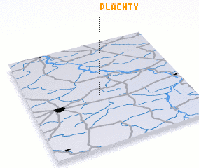 Places with similar names to Płachty, Poland ::
// Pląchoty (PL)
// Plichta (PL)
// Plichtów (PL)
// Plisht (AL)
// Palāshāti (BD)
// Palshet (IN)
// Palasht (IR)
// Pelishat (BG)
// Plei Chuêt (VN)
// Pơlei Chưot (VN)
Disclaimer :: Information on this page comes without warranty of any kind |
||
|
Where is Płachty? Elevation and coordinates ::
Latitude (lat): 51°28'0"N Longitude (lon): 21°27'0"E
Elevation (approx.): 145m (map arrows pan, magnifying glasses zoom) |
||
|
Visiting Płachty? Hotel/Accommodation ::
Book a hotel in Płachty Travel Guide ::
Buy a travel guide for Poland rental cars ::
car rental offers GPS waypoint ::
download a GPX waypoint (PoI) of Płachty for your GPS receiver
|
||