|
search place name
|
||
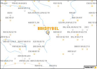
Bakonybél (Veszprém, Hungary)Bakonybél is a town in the Veszprém region of Hungary. An overview map of the region around Bakonybél is displayed below.
regional and 3d topo map of Bakonybél, Hungary ::
Bakonybél airports ::
The nearest airport is BTS - Bratislava M R Stefanik, located 109.5 km north of Bakonybél.
Other airports nearby include BUD - Budapest Ferihegy (116.9 km east), VIE - Vienna Schwechat (129.5 km north west), PZY - Piestany (153.1 km north), SLD - Sliac (186.4 km north east), Nearby towns ::
Somhegy (2.5km east) //
Gerencepuszta (3.9km north) //
Szénégető (4.5km south west) //
Pénzesgyőr (4.2km south east) //
Kerteskő (4.2km south east) //
Öreghálás (6.1km south west) //
Hubertlak (5.3km north west) //
Kisszépalmapuszta (6.7km north east) //
Huszárokelőpuszta (7.8km north) //
Szépalmapuszta (6.2km north east) //
Gombáspuszta (8.3km south east) //
Csehbánya (8.3km south west) //
[all distances 'as the bird flies' and approximate] 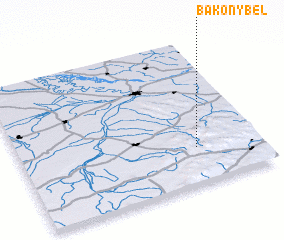 Places with similar names to Bakonybél, Hungary ::
// Beukenbeul (DE)
// Behkīn-e Bālā (IR)
// Bakounbila (BF)
// Bokouanbolo (CG)
// Bgān Bāla (PK)
// Bogonibélé (ML)
// Bakohnbli (LR)
// Bakohnbli (LR)
// Bakonbli (LR)
Disclaimer :: Information on this page comes without warranty of any kind |
||
|
Where is Bakonybél? Elevation and coordinates ::
Latitude (lat): 47°15'0"N Longitude (lon): 17°44'0"E
Elevation (approx.): 307m (map arrows pan, magnifying glasses zoom) |
||
|
Visiting Bakonybél? Hotel/Accommodation ::
Book a hotel in Bakonybél Travel Guide ::
Buy a travel guide for Hungary rental cars ::
car rental offers GPS waypoint ::
download a GPX waypoint (PoI) of Bakonybél for your GPS receiver
|
||