|
search place name
|
||
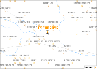
Csehbánya (Veszprém, Hungary)Csehbánya is a town in the Veszprém region of Hungary. An overview map of the region around Csehbánya is displayed below.
regional and 3d topo map of Csehbánya, Hungary ::
Csehbánya airports ::
The nearest airport is BTS - Bratislava M R Stefanik, located 115.3 km north of Csehbánya.
Other airports nearby include BUD - Budapest Ferihegy (122.2 km east), VIE - Vienna Schwechat (132.7 km north west), PZY - Piestany (160.7 km north), MBX - Maribor (171.3 km south west), Nearby towns ::
Széplábitanya (2.2km south west) //
Öreghálás (2.2km north east) //
Vámosmajor (3.1km south west) //
Boncsodpuszta (3.9km south) //
Szénégető (3.9km north) //
Újmajor (4.5km south west) //
Városlőd (4.5km south west) //
Németbánya (4.5km north west) //
Farkasgyepů (4.2km north west) //
Mészmů (5.7km south) //
Remete (5.7km south) //
Keresztmajor (5.4km west) //
Kislőd (6.3km south west) //
Parésbörc (8.3km south east) //
Bereczpuszta (8.3km south east) //
Csalánostanya (8.3km south east) //
Szentgál (8.3km south east) //
Bakonybél (8.3km north east) //
Herend (7.5km south east) //
[all distances 'as the bird flies' and approximate] 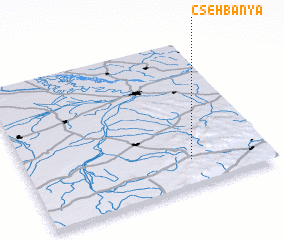 Places with similar names to Csehbánya, Hungary :: Disclaimer :: Information on this page comes without warranty of any kind |
||
|
Where is Csehbánya? Elevation and coordinates ::
Latitude (lat): 47°11'0"N Longitude (lon): 17°41'0"E
Elevation (approx.): 376m (map arrows pan, magnifying glasses zoom) |
||
|
Visiting Csehbánya? Hotel/Accommodation ::
Book a hotel in Csehbánya Travel Guide ::
Buy a travel guide for Hungary rental cars ::
car rental offers GPS waypoint ::
download a GPX waypoint (PoI) of Csehbánya for your GPS receiver
|
||