|
search place name
|
||
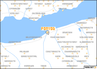
Fonyód (Somogy, Hungary)Fonyód is a town in the Somogy region of Hungary. An overview map of the region around Fonyód is displayed below.
regional and 3d topo map of Fonyód, Hungary ::
nearby GPS traces from timatio ::
Fonyód airports ::
The nearest airport is MBX - Maribor, located 145.5 km west of Fonyód.
Other airports nearby include BUD - Budapest Ferihegy (151.3 km north east), ZAG - Zagreb (158.7 km south west), BTS - Bratislava M R Stefanik (161.8 km north), VIE - Vienna Schwechat (170.0 km north west), Nearby towns ::
Fehérbézseny (2.5km east) //
Feketebézseny (3.1km south east) //
Balatonfenyves (4.2km south west) //
Ordacsehi (5.1km east) //
Csisztapuszta (7.5km south) //
Badacsonyörs (7.5km north) //
Pusztaberény (6.7km south east) //
Badacsony (6.7km north west) //
Pusztaszentgyörgy (6.3km south east) //
Felsőkolónia (7.8km north) //
Csángó (7.8km north) //
Badacsonytomaj (7.8km north) //
Riczepuszta (7.5km south east) //
[all distances 'as the bird flies' and approximate] 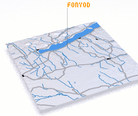
Disclaimer :: Information on this page comes without warranty of any kind |
||
|
Where is Fonyód? Elevation and coordinates ::
Latitude (lat): 46°44'0"N Longitude (lon): 17°33'0"E
Elevation (approx.): 131m (map arrows pan, magnifying glasses zoom) |
||
|
Visiting Fonyód? Hotel/Accommodation ::
Book a hotel in Fonyód Travel Guide ::
Buy a travel guide for Hungary rental cars ::
car rental offers GPS waypoint ::
download a GPX waypoint (PoI) of Fonyód for your GPS receiver
|
||