|
search place name
|
||
Kisbudmér (Baranya, Hungary)Kisbudmér is a town in the Baranya region of Hungary. An overview map of the region around Kisbudmér is displayed below.
regional and 3d topo map of Kisbudmér, Hungary ::

Kisbudmér airports ::
The nearest airport is OSI - Osijek, located 57.4 km south east of Kisbudmér.
Other airports nearby include BUD - Budapest Ferihegy (180.4 km north), BEG - Beograd (189.9 km south east), Nearby towns ::
Kisjakabfalva (2.1km south west) //
Pócsa (1.8km east) //
Nagybudmér (2.6km north) //
Borjád (2.8km north east) //
Ivánbattyán (2.4km west) //
Pócsapuszta (2.9km south east) //
Villánykövesd (3.8km south west) //
Fánipuszta (3.4km south west) //
Villány (4.9km south) //
Virágos (4.5km south east) //
Marótszentmárton (4.8km south east) //
Palkonya (4.8km west) //
Ivánszőlős (5.6km north west) //
Belvárdgyula (6.7km north) //
Kiskassa (5.9km north west) //
Palkonyapuszta (5.0km west) //
Békáspuszta (6.6km north east) //
Márok (6.4km south east) //
Pécsdevecser (6.9km north west) //
Magyarbóly (8.5km south east) //
Nagyharsány (8.5km south west) //
Gyulapuszta (9.1km north) //
Sziebertpuszta (8.1km north east) //
Bóly (8.2km north east) //
[all distances 'as the bird flies' and approximate] 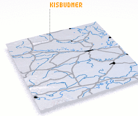 Places with similar names to Kisbudmér, Hungary ::
// Qaşabat ‘Ammār (TN)
Disclaimer :: Information on this page comes without warranty of any kind |
||
|
Where is Kisbudmér? Elevation and coordinates ::
Latitude (lat): 45°54'45"N Longitude (lon): 18°26'51"E
Elevation (approx.): 103m (map arrows pan, magnifying glasses zoom) |
||
|
Visiting Kisbudmér? Hotel/Accommodation ::
Book a hotel in Kisbudmér Travel Guide ::
Buy a travel guide for Hungary rental cars ::
car rental offers GPS waypoint ::
download a GPX waypoint (PoI) of Kisbudmér for your GPS receiver
|
||