|
search place name
|
||
Sziebertpuszta (Baranya, Hungary)Sziebertpuszta is a town in the Baranya region of Hungary. An overview map of the region around Sziebertpuszta is displayed below.
regional and 3d topo map of Sziebertpuszta, Hungary ::

Sziebertpuszta airports ::
The nearest airport is OSI - Osijek, located 60.5 km south of Sziebertpuszta.
Other airports nearby include BUD - Budapest Ferihegy (172.9 km north), BEG - Beograd (189.7 km south east), Nearby towns ::
Bóly (0.1km north east) //
Szajk (2.9km north east) //
Versend (3.2km north) //
Békáspuszta (2.4km west) //
Trischlerpuszta (3.7km north) //
Lajosmajor (3.5km east) //
Monyoród (4.5km north west) //
Babarc (4.6km north east) //
Töttös (6.0km south) //
Borjád (5.3km south west) //
Nagynyárád (5.4km south east) //
Szederkény (5.7km north west) //
Babarcpuszta (7.4km north) //
Kisvizslaktanya (5.5km east) //
Újistálló (5.5km east) //
Pócsa (7.3km south west) //
Bácsfapuszta (6.3km north east) //
Nagybudmér (6.5km south west) //
Pócsapuszta (8.2km south) //
Máriakéménd (8.4km north west) //
Kisnyárád (8.4km north east) //
Kisbudmér (8.1km south west) //
Ormánypuszta (10.6km south east) //
[all distances 'as the bird flies' and approximate] 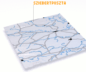 Places with similar names to Sziebertpuszta, Hungary :: Disclaimer :: Information on this page comes without warranty of any kind |
||
|
Where is Sziebertpuszta? Elevation and coordinates ::
Latitude (lat): 45°58'0"N Longitude (lon): 18°31'0"E
Elevation (approx.): 135m (map arrows pan, magnifying glasses zoom) |
||
|
Visiting Sziebertpuszta? Hotel/Accommodation ::
Book a hotel in Sziebertpuszta Travel Guide ::
Buy a travel guide for Hungary rental cars ::
car rental offers GPS waypoint ::
download a GPX waypoint (PoI) of Sziebertpuszta for your GPS receiver
|
||