|
search place name
|
||
Petkūnai (Lithuania)Petkūnai is a town in Lithuania. An overview map of the region around Petkūnai is displayed below.
regional and 3d topo map of Petkūnai, Lithuania ::
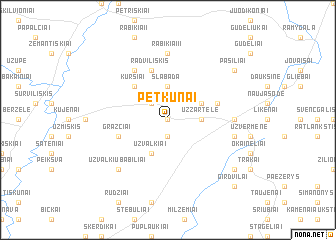
Nearby towns ::
Pročiūnai (0.0km north) //
Vidulaukiai (1.9km south) //
Norušiai (2.1km north west) //
Užžartėlė (2.1km east) //
Slabada (3.7km north) //
Dvariškiai (2.8km north east) //
Užvalkiai (3.9km south) //
Kuršiai (4.3km north west) //
Grąžčiai (3.7km south west) //
Linkaučiai (5.7km north) //
Radviliškis (5.7km north) //
Pašilėliai (3.7km north east) //
Butrimoniai (5.9km north) //
Jateliškiai (5.9km north) //
Truskava (4.2km east) //
Rabikiai II (7.4km north) //
Pavermenys (4.6km south east) //
Užvalkių-Babiliai (6.4km south west) //
Pašiliai (7.0km north east) //
Okainiai (7.0km south east) //
Girdvilai (8.5km south east) //
[all distances 'as the bird flies' and approximate] 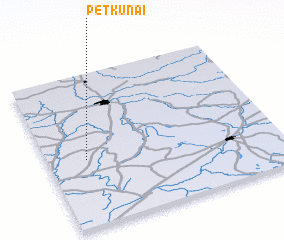 Places with similar names to Petkūnai, Lithuania ::
Disclaimer :: Information on this page comes without warranty of any kind |
||
|
Where is Petkūnai? Elevation and coordinates ::
Latitude (lat): 55°26'0"N Longitude (lon): 24°10'0"E
Elevation (approx.): 54m (map arrows pan, magnifying glasses zoom) |
||
|
Visiting Petkūnai? Hotel/Accommodation ::
Book a hotel in Petkūnai Travel Guide ::
Buy a travel guide for Lithuania rental cars ::
car rental offers GPS waypoint ::
download a GPX waypoint (PoI) of Petkūnai for your GPS receiver
|
||