|
search place name
|
||
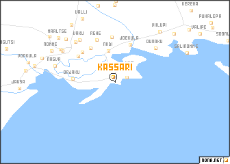
Kassari (Hiiumaa, Estonia)Kassari is a town in the Hiiumaa region of Estonia. An overview map of the region around Kassari is displayed below.
regional and 3d topo map of Kassari, Estonia ::
Kassari airports ::
The nearest airport is TLL - Tallinn-ulemiste International Tallinn, located 133.6 km north east of Kassari.
Other airports nearby include TKU - Turku (195.1 km north), Nearby towns ::
Esiküla (2.0km north) //
Taguküla (1.3km north east) //
Kiisi (2.4km north east) //
Niidi (5.1km north) //
Jõeküla (6.2km north) //
Vaemla (5.9km north) //
Orjaku (3.6km west) //
Putkaste (5.6km north west) //
Käina (5.2km north west) //
Kaasiku (7.3km north) //
Rehe (7.1km north) //
Kogri (7.1km north) //
Õunaku (6.5km north east) //
Vaku (7.4km north west) //
Allika (7.4km north west) //
Mäe (6.7km north west) //
Moka (7.0km north west) //
Ristivälja (8.1km north west) //
Viilupi (9.0km north east) //
[all distances 'as the bird flies' and approximate] 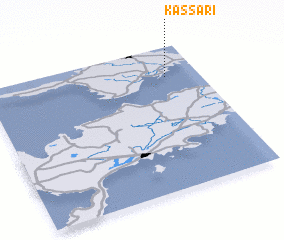 Places with similar names to Kassari, Estonia ::
Disclaimer :: Information on this page comes without warranty of any kind |
||
|
Where is Kassari? Elevation and coordinates ::
Latitude (lat): 58°47'16"N Longitude (lon): 22°50'36"E
Elevation (approx.): 5m (map arrows pan, magnifying glasses zoom) |
||
|
Visiting Kassari? Hotel/Accommodation ::
Book a hotel in Kassari Travel Guide ::
Buy a travel guide for Estonia rental cars ::
car rental offers GPS waypoint ::
download a GPX waypoint (PoI) of Kassari for your GPS receiver
|
||