|
search place name
|
||
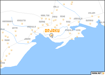
Orjaku (Hiiumaa, Estonia)Orjaku is a town in the Hiiumaa region of Estonia. An overview map of the region around Orjaku is displayed below.
regional and 3d topo map of Orjaku, Estonia ::
Orjaku airports ::
The nearest airport is TKU - Turku, located 194.1 km north of Orjaku.
Nearby towns ::
Nasva (2.6km north west) //
Käina (3.7km north) //
Putkaste (4.5km north) //
Mäe (4.7km north) //
Moka (5.0km north) //
Vaemla (5.2km north) //
Nõmme (4.9km north) //
Selja (4.3km north west) //
Allika (6.1km north) //
Esiküla (3.5km north east) //
Vaku (6.4km north) //
Ristivälja (6.5km north) //
Luguse (3.9km north west) //
Kassari (3.6km east) //
Määltse (6.9km north) //
Niidi (5.4km north east) //
Rehe (6.7km north) //
Kogri (6.7km north) //
Võnküla (4.6km north west) //
Utu (4.2km west) //
Kolga (7.2km north) //
Taguküla (4.6km east) //
Kreiandi (8.8km north) //
Jausa (4.8km west) //
Kaasiku (7.6km north east) //
[all distances 'as the bird flies' and approximate] 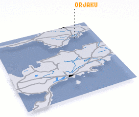
Disclaimer :: Information on this page comes without warranty of any kind |
||
|
Where is Orjaku? Elevation and coordinates ::
Latitude (lat): 58°47'32"N Longitude (lon): 22°46'55"E
Elevation (approx.): 1m (map arrows pan, magnifying glasses zoom) |
||
|
Visiting Orjaku? Hotel/Accommodation ::
Book a hotel in Orjaku Travel Guide ::
Buy a travel guide for Estonia rental cars ::
car rental offers GPS waypoint ::
download a GPX waypoint (PoI) of Orjaku for your GPS receiver
|
||