|
search place name
|
||
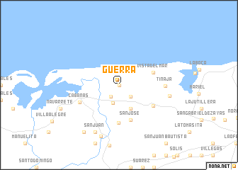
Guerra (La Habana, Cuba)Guerra is a town in the La Habana region of Cuba. An overview map of the region around Guerra is displayed below.
regional and 3d topo map of Guerra, Cuba ::
Guerra airports ::
The nearest airport is HAV - Havana Jose Marti Intl, located 46.9 km east of Guerra.
Other airports nearby include LCL - La Coloma (108.4 km south west), GER - Nueva Gerona Rafael Cabrera (129.3 km south), VRA - Varadero Juan Gualberto Gomez Intl (146.8 km east), CYO - Cayo Vilo Acuna Intl (204.9 km south east), Nearby towns ::
Varela (0.0km north) //
Dos Hermanos (2.2km south west) //
Ramos (2.5km south east) //
Santa Isabel (3.0km south) //
San Idelfonso (4.1km south east) //
Vista del Mar (5.4km east) //
San José (5.8km south) //
San Miguel (6.0km south) //
Quiebra Hacha (5.9km south east) //
Cabañas (6.3km south west) //
Tinaja (6.7km east) //
Angosta (7.5km east) //
San Juan (8.2km south west) //
Encrucijado (8.5km south) //
Patabanal (9.0km south west) //
[all distances 'as the bird flies' and approximate]  Places with similar names to Guerra, Cuba ::
Disclaimer :: Information on this page comes without warranty of any kind |
||
|
Where is Guerra? Elevation and coordinates ::
Latitude (lat): 23°0'0"N Longitude (lon): 82°52'0"W
Elevation (approx.): 33m (map arrows pan, magnifying glasses zoom) |
||
|
Visiting Guerra? Hotel/Accommodation ::
Book a hotel in Guerra Travel Guide ::
Buy a travel guide for Cuba rental cars ::
car rental offers GPS waypoint ::
download a GPX waypoint (PoI) of Guerra for your GPS receiver
|
||