|
search place name
|
||
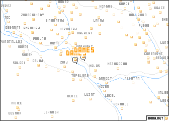
Damës (Gjirokastër, Albania)Damës is a town in the Gjirokastër region of Albania. An overview map of the region around Damës is displayed below.
regional and 3d topo map of Damës, Albania ::
Damës airports ::
The nearest airport is CFU - Kerkyra/corfu Ioannis Kapodistrias Intl, located 81.9 km south of Damës.
Other airports nearby include IOA - Ioannina (98.1 km south east), KSO - Kastoria Aristotelis (107.3 km east), OHD - Ohrid (111.7 km north east), TIA - Tirana Rinas (122.7 km north), Nearby towns ::
Damës (1.5km south west) //
Kashisht (2.1km north) //
Bofëngë (1.8km north west) //
Malas (2.7km south east) //
Mamaj (3.2km south west) //
Kallëmb (2.9km north west) //
Bylysh (3.5km north west) //
Beçisht (3.9km south east) //
(( Beluç i Sipërm )) (4.0km north) //
Tepelenë (4.3km south) //
Ziaj (3.7km west) //
Veliqot (4.6km south west) //
Vagalat (5.1km north) //
Memaliaj-Fshat (4.3km west) //
Memaliaj (4.4km north west) //
Çërrilë (5.1km north west) //
Turan (5.1km south west) //
Arrëza e Madhe (6.5km north east) //
Toskë-Martalloz (6.6km north) //
Dragot (6.1km south east) //
Kërvacaj (6.6km north west) //
Mirnë (5.7km north west) //
Ballaj (6.4km north west) //
Maricaj (7.2km north) //
Mezhgoran (5.9km east) //
Kodër (7.4km south east) //
Cacaj (7.5km north west) //
Luzat (8.5km south) //
Lamaj (8.3km north) //
[all distances 'as the bird flies' and approximate] 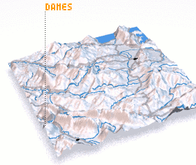 Places with similar names to Damës, Albania ::
Disclaimer :: Information on this page comes without warranty of any kind |
||
|
Where is Damës? Elevation and coordinates ::
Latitude (lat): 40°20'3"N Longitude (lon): 20°1'37"E
Elevation (approx.): 368m (map arrows pan, magnifying glasses zoom) |
||
|
Visiting Damës? Hotel/Accommodation ::
Book a hotel in Damës Travel Guide ::
Buy a travel guide for Albania rental cars ::
car rental offers GPS waypoint ::
download a GPX waypoint (PoI) of Damës for your GPS receiver
|
||