|
search place name
|
||
Kaferr (Elbasan, Albania)Kaferr is a town in the Elbasan region of Albania. An overview map of the region around Kaferr is displayed below.
regional and 3d topo map of Kaferr, Albania ::

Kaferr airports ::
The nearest airport is OHD - Ohrid, located 51.4 km north east of Kaferr.
Other airports nearby include TIA - Tirana Rinas (62.9 km north west), KSO - Kastoria Aristotelis (109.1 km south east), IOA - Ioannina (151.7 km south), CFU - Kerkyra/corfu Ioannis Kapodistrias Intl (154.4 km south), Nearby towns ::
Paraspun (1.2km south) //
Xibresh (1.8km north east) //
Shumeplaku (2.0km north west) //
Valësh (2.9km north) //
Seltë (2.5km south east) //
Manth (2.7km north east) //
Velak (3.4km south) //
Maskarth (3.8km north) //
Nezhan (3.0km east) //
Panç (3.2km west) //
Pashtresh (4.2km north east) //
Arçovë (3.8km south east) //
Galigat (4.2km south west) //
Gjinar (5.2km north) //
Stërstan (4.6km north west) //
Holtë (5.5km south) //
Bizhdan (4.2km west) //
Liras (5.6km south) //
Zall (4.5km north west) //
Shesh (5.1km south east) //
Stror (6.0km south) //
Kotorr (5.7km south) //
Shemat (4.7km east) //
Cingari i Sipërm (5.0km south west) //
Kaçivel (5.4km west) //
Lukan (6.6km north west) //
Dërstilë (7.2km north) //
Gjergjovinë (6.5km south west) //
Sinani (6.8km south east) //
[all distances 'as the bird flies' and approximate] 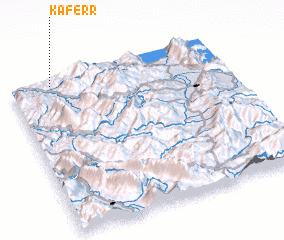 Places with similar names to Kaferr, Albania ::
Disclaimer :: Information on this page comes without warranty of any kind |
||
|
Where is Kaferr? Elevation and coordinates ::
Latitude (lat): 40°58'32"N Longitude (lon): 20°11'39"E
Elevation (approx.): 593m (map arrows pan, magnifying glasses zoom) |
||
|
Visiting Kaferr? Hotel/Accommodation ::
Book a hotel in Kaferr Travel Guide ::
Buy a travel guide for Albania rental cars ::
car rental offers GPS waypoint ::
download a GPX waypoint (PoI) of Kaferr for your GPS receiver
|
||