|
search place name
|
||
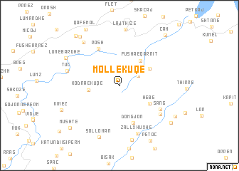
Mollëkuqe (Shkodër, Albania)Mollëkuqe is a town in the Shkodër region of Albania. An overview map of the region around Mollëkuqe is displayed below.
regional and 3d topo map of Mollëkuqe, Albania ::
Mollëkuqe airports ::
The nearest airport is TIA - Tirana Rinas, located 75.2 km south west of Mollëkuqe.
Other airports nearby include TGD - Podgorica (82.7 km north west), PRN - Pristina (96.5 km north east), OHD - Ohrid (105.5 km south east), SKP - Skopje (123.0 km east), Nearby towns ::
Srriqe (2.7km north east) //
Kodra e Kuqe (3.7km west) //
Fusha e Qarrit (4.6km north east) //
Arat e Mira (4.4km north east) //
Hebë (4.4km south east) //
Domgjon (6.0km south) //
Rosh (6.3km north west) //
Sang (6.0km south east) //
Sung (6.5km south east) //
Zall-Xhuxhë (7.7km south) //
Tuç (6.6km west) //
Solloman (8.3km south) //
Shtalth (8.6km south) //
Lajthizë (8.8km north) //
Palucaj (8.0km north west) //
Lumëbardhë (7.6km north west) //
Petoc (9.3km south) //
Mrijaj (8.9km north west) //
Xhuxhë (8.3km south east) //
Lashtë (8.0km south east) //
Mushtë (8.7km south west) //
Qafëmal (9.6km north west) //
Vasiaj (9.3km north west) //
Cam (9.5km north east) //
[all distances 'as the bird flies' and approximate] 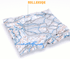 Places with similar names to Mollëkuqe, Albania ::
// Mialkougou (CM)
// Mèlako-auk (MM)
// Mǝlcǝk (AZ)
// Malaguikay (PH)
// Milokokkiá (GR)
// Melgaço (PT)
// Malakówka (PL)
// Mały Kack (PL)
// Miłkówko (PL)
// Mallkeq (AL)
Disclaimer :: Information on this page comes without warranty of any kind |
||
|
Where is Mollëkuqe? Elevation and coordinates ::
Latitude (lat): 42°0'52"N Longitude (lon): 20°8'20"E
Elevation (approx.): 713m (map arrows pan, magnifying glasses zoom) |
||
|
Visiting Mollëkuqe? Hotel/Accommodation ::
Book a hotel in Mollëkuqe Travel Guide ::
Buy a travel guide for Albania rental cars ::
car rental offers GPS waypoint ::
download a GPX waypoint (PoI) of Mollëkuqe for your GPS receiver
|
||