|
search place name
|
||
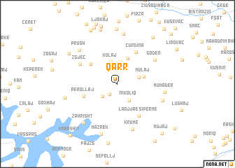
Qarr (Kukës, Albania)Qarr is a town in the Kukës region of Albania. An overview map of the region around Qarr is displayed below.
regional and 3d topo map of Qarr, Albania ::
Qarr airports ::
The nearest airport is PRN - Pristina, located 63.3 km north east of Qarr.
Other airports nearby include TGD - Podgorica (94.6 km west), SKP - Skopje (107.0 km east), TIA - Tirana Rinas (109.3 km south west), OHD - Ohrid (123.6 km south), Nearby towns ::
Golaj (1.8km south west) //
Letaj (2.7km north) //
Dautaj (2.7km south west) //
Nikoliq (3.0km south east) //
Çinaj (3.2km north) //
Kurpal (3.6km north) //
Dobrunë (2.8km north east) //
Kolaj (3.6km north) //
Zulfaj (4.2km north) //
Mulaj (3.4km east) //
Peraj (4.5km north west) //
Perollaj (4.5km south west) //
Ćurdina (5.5km north east) //
Lagjja e Sipërme (5.7km south east) //
Zgjeç (5.4km north west) //
Goden (5.8km north east) //
Krumë (7.4km south) //
Muhadër (5.7km east) //
Vlahën (6.0km south east) //
(( Fushë Lumë )) (8.0km north) //
Prush (7.1km north west) //
Zahrisht (7.4km south west) //
Mazrek (8.3km south) //
Muçaj (6.6km west) //
Žub (8.8km north) //
Kukaj (8.9km north) //
Xhuxhaj (7.6km north west) //
Kusare (8.5km north east) //
Kolonija (9.1km north) //
[all distances 'as the bird flies' and approximate]  Places with similar names to Qarr, Albania ::
Disclaimer :: Information on this page comes without warranty of any kind |
||
|
Where is Qarr? Elevation and coordinates ::
Latitude (lat): 42°15'42"N Longitude (lon): 20°23'30"E
Elevation (approx.): 498m (map arrows pan, magnifying glasses zoom) |
||
|
Visiting Qarr? Hotel/Accommodation ::
Book a hotel in Qarr Travel Guide ::
Buy a travel guide for Albania rental cars ::
car rental offers GPS waypoint ::
download a GPX waypoint (PoI) of Qarr for your GPS receiver
|
||