|
search place name
|
||
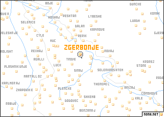
Zgërbonjë (Berat, Albania)Zgërbonjë is a town in the Berat region of Albania. An overview map of the region around Zgërbonjë is displayed below.
regional and 3d topo map of Zgërbonjë, Albania ::
Zgërbonjë airports ::
The nearest airport is OHD - Ohrid, located 86.0 km north east of Zgërbonjë.
Other airports nearby include TIA - Tirana Rinas (97.0 km north), KSO - Kastoria Aristotelis (102.5 km east), CFU - Kerkyra/corfu Ioannis Kapodistrias Intl (110.3 km south), IOA - Ioannina (117.0 km south east), Nearby towns ::
Kaluç (1.6km east) //
Pronovik (1.6km east) //
Usti (1.8km south east) //
Trove (2.2km south west) //
Vojak (2.4km north west) //
Poliçan (3.0km north) //
Plirëzë (3.1km north) //
Valë (3.3km south east) //
Sinaj (3.9km south) //
Perik (4.1km north) //
Çepan (4.3km north) //
Dollan (4.0km south west) //
Tozhar (4.4km south west) //
Jaupas (3.8km east) //
Ballë (4.7km north east) //
Nishovë (4.0km north east) //
Palec (5.1km south) //
Bargullas (4.2km north east) //
Mbrakull (5.1km north) //
Fushtan (5.1km south) //
Teman (4.1km west) //
Ball (5.5km north) //
Vizhar (5.9km south) //
Vërtop (5.5km north west) //
Luçk (4.9km south west) //
Sinec (5.8km south west) //
Niçaj (4.7km west) //
Hadaj (5.1km north west) //
Calaj (4.8km west) //
[all distances 'as the bird flies' and approximate]  Places with similar names to Zgërbonjë, Albania :: Disclaimer :: Information on this page comes without warranty of any kind |
||
|
Where is Zgërbonjë? Elevation and coordinates ::
Latitude (lat): 40°35'11"N Longitude (lon): 20°5'14"E
Elevation (approx.): 397m (map arrows pan, magnifying glasses zoom) |
||
|
Visiting Zgërbonjë? Hotel/Accommodation ::
Book a hotel in Zgërbonjë Travel Guide ::
Buy a travel guide for Albania rental cars ::
car rental offers GPS waypoint ::
download a GPX waypoint (PoI) of Zgërbonjë for your GPS receiver
|
||