|
search place name
|
||
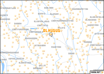
Al Ḩudūd (Kafr ash Shaykh, Egypt)Al Ḩudūd is a town in the Kafr ash Shaykh region of Egypt. An overview map of the region around Al Ḩudūd is displayed below.
regional and 3d topo map of Al Ḩudūd, Egypt ::
Al Ḩudūd airports ::
The nearest airport is ALY - Alexandria Intl, located 89.2 km west of Al Ḩudūd.
Other airports nearby include CAI - Cairo Intl (124.3 km south east), PSD - Port Said (130.1 km east), Nearby towns ::
‘Izbat Muşţafá al ‘Īsawī (1.1km south west) //
‘Izbat Aḩmad Ḩilmī (1.4km north east) //
‘Izbat Muḩammad Şalāḩ (1.6km north west) //
‘Izbat ‘Alī ‘Arab (1.7km west) //
Maḩallat al Qaşab (1.8km south east) //
‘Izbat al Awqāf (2.1km north) //
‘Izbat al Ghamrīyah (2.0km north west) //
‘Izbat Muşţafá Kāmil (2.1km south west) //
‘Izbat Aḩmad al ‘Īsawī (2.4km south) //
‘Izbat Rashwān Āghā (2.6km south west) //
Al Bakhānīs (3.0km north) //
Al Ḩamrah (2.8km north west) //
‘Izbat ‘Abd Allāh al Wakīl (2.7km west) //
‘Izbat Yūsuf Şabrī al Jadīdah (3.0km south west) //
Bilshāshah (3.1km west) //
Kafr al Manshī al Baḩrī (3.5km north east) //
Ḩulays (3.8km north east) //
Aryamûn (4.2km north east) //
‘Izbat Ḩasan an Naklāwī (3.8km west) //
‘Izbat Zayīd (4.4km north west) //
‘Izbat ash Shaykh (4.4km north west) //
Ruwaynah (4.8km south) //
‘Izbat Khūrshīd (4.5km south west) //
‘Izbat Ţāhir (4.4km west) //
Ṣandala (4.7km west) //
Abū Tamādah (4.8km east) //
Mīt ad Dībah (5.3km south west) //
‘Izbat Şandalā (5.0km west) //
An Naţţāf (5.7km south) //
[all distances 'as the bird flies' and approximate]  Places with similar names to Al Ḩudūd, Egypt ::
// Al Ḩudayd (IQ)
// Al Ḩaddād (EG)
// Al Ḩaddādī (EG)
// Al Ḩaddādah (TN)
// Al Hedet (TD)
// Al Ḩaddādah (SA)
// Al Ḩudayd (SD)
// Al Ḩaddādah (JO)
// Al Ḩidādah (SY)
// Al Ḩadāʼidah (EG)
Disclaimer :: Information on this page comes without warranty of any kind |
||
|
Where is Al Ḩudūd? Elevation and coordinates ::
Latitude (lat): 31°8'55"N Longitude (lon): 30°53'0"E
Elevation (approx.): 4m (map arrows pan, magnifying glasses zoom) |
||
|
Visiting Al Ḩudūd? Hotel/Accommodation ::
Book a hotel in Al Ḩudūd Travel Guide ::
Buy a travel guide for Egypt rental cars ::
car rental offers GPS waypoint ::
download a GPX waypoint (PoI) of Al Ḩudūd for your GPS receiver
|
||