|
search place name
|
||
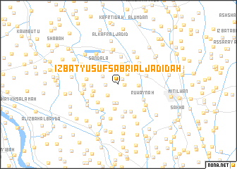
‘Izbat Yūsuf Şabrī al Jadīdah (Kafr ash Shaykh, Egypt)‘Izbat Yūsuf Şabrī al Jadīdah is a town in the Kafr ash Shaykh region of Egypt. An overview map of the region around ‘Izbat Yūsuf Şabrī al Jadīdah is displayed below.
regional and 3d topo map of ‘Izbat Yūsuf Şabrī al Jadīdah, Egypt ::
‘Izbat Yūsuf Şabrī al Jadīdah airports ::
The nearest airport is ALY - Alexandria Intl, located 87.2 km west of ‘Izbat Yūsuf Şabrī al Jadīdah.
Other airports nearby include CAI - Cairo Intl (123.2 km south east), PSD - Port Said (132.5 km east), Nearby towns ::
‘Izbat Rashwān Āghā (0.8km east) //
‘Izbat Muşţafá Kāmil (1.0km north east) //
‘Izbat Khūrshīd (1.7km west) //
‘Izbat Muşţafá al ‘Īsawī (2.0km north east) //
‘Izbat ‘Abd Allāh al Wakīl (2.2km north) //
Mīt ad Dībah (2.3km south west) //
Bilshāshah (2.8km north) //
‘Izbat Ţāhir (2.5km north west) //
‘Izbat ‘Alī ‘Arab (2.8km north) //
‘Izbat Ḩasan an Naklāwī (2.7km north west) //
‘Izbat ‘Alī Ibrāhīm (3.0km south) //
‘Izbat al Ḩārith (3.0km south) //
‘Izbat Aḩmad al ‘Īsawī (2.8km east) //
‘Izbat al Ghamrīyah (3.2km north) //
Al Ḩudūd (3.0km north east) //
‘Izbat Muḩammad Şalāḩ (3.3km north) //
‘Izbat Abū al Jadāyil (3.9km south) //
‘Izbat Muḩammad al Ḩalīm (3.5km west) //
Ṣandala (4.0km north west) //
‘Izbat Iflāţūn (3.7km west) //
Ţawīlat Nashart (4.0km south west) //
Al Ḩamrah (4.4km north) //
Rizqat ash Shinnāwī al Ḩamīdīyah (4.4km south) //
‘Izbat Şalāḩ Shukrī (3.9km south west) //
‘Izbat Şandalā (4.2km north west) //
Maḩallat al Qaşab (4.0km east) //
Ruwaynah (4.2km south east) //
‘Izbat Aḩmad Ḩilmī (4.4km north east) //
‘Izbat al Muftī (4.7km south) //
[all distances 'as the bird flies' and approximate]  Places with similar names to ‘Izbat Yūsuf Şabrī al Jadīdah, Egypt :: Disclaimer :: Information on this page comes without warranty of any kind |
||
|
Where is ‘Izbat Yūsuf Şabrī al Jadīdah? Elevation and coordinates ::
Latitude (lat): 31°7'44"N Longitude (lon): 30°51'40"E
Elevation (approx.): 2m (map arrows pan, magnifying glasses zoom) |
||
|
Visiting ‘Izbat Yūsuf Şabrī al Jadīdah? Hotel/Accommodation ::
Book a hotel in ‘Izbat Yūsuf Şabrī al Jadīdah Travel Guide ::
Buy a travel guide for Egypt rental cars ::
car rental offers GPS waypoint ::
download a GPX waypoint (PoI) of ‘Izbat Yūsuf Şabrī al Jadīdah for your GPS receiver
|
||