|
search place name
|
||
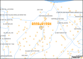
An Najāyrah (Ad Daqahlīyah, Egypt)An Najāyrah is a town in the Ad Daqahlīyah region of Egypt. An overview map of the region around An Najāyrah is displayed below.
regional and 3d topo map of An Najāyrah, Egypt ::
An Najāyrah airports ::
The nearest airport is PSD - Port Said, located 70.4 km east of An Najāyrah.
Other airports nearby include CAI - Cairo Intl (134.5 km south), ALY - Alexandria Intl (148.9 km west), Nearby towns ::
Kafr at Tibn (0.3km north west) //
Minshāt an Naşr (0.6km north) //
Kafr Yūsuf (1.0km east) //
‘Izbat Ibrāhīm Ju‘ayşah (1.3km north east) //
Kafr Umm as Su‘ūd (1.5km north east) //
Kafr Sharīf (1.6km south east) //
Kafr Abū Nūr ad Dīn (2.1km south west) //
Kafr al Wakālah (2.6km north east) //
Kafr al Aţrash (3.1km south) //
‘Izbat al Murabba‘ (3.0km north east) //
‘Izbat Jān ‘Īd (3.6km north) //
‘Izbat ‘Abd an Nabī (3.5km south west) //
Kafr al ‘Atal (3.8km south) //
‘Izbat Darwīsh ‘Alī (3.7km south west) //
Kafr Abū Fūdah (4.0km south) //
‘Izbat Yūsif al ‘Ishsh (4.3km north) //
‘Izbat as Sunbāţī (4.5km south) //
‘Izbat Aḩmad Abū as Su‘ūd (4.5km south) //
Kafr al Murābi‘īn (4.8km north) //
Kafr Abū Sayyid Aḩmad (5.0km south) //
‘Izbat Abū Sa‘ādah al Kubrá (4.4km east) //
‘Izbat ash Shaţţ al Baḩrīyah (4.6km south east) //
Manshīyat Abū Ḩaţab (5.1km north) //
Kufûr el-Ghâb (5.2km north) //
‘Izbat Abū Lāshīn (5.0km south east) //
Kafr Abū ‘Ayyād (5.4km north) //
Kafr Abu Zâhir (5.4km south) //
Kafr ad Dahāʼimah (5.4km north) //
‘Izbat al Khamīs (5.3km south west) //
[all distances 'as the bird flies' and approximate] 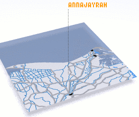 Places with similar names to An Najāyrah, Egypt ::
Disclaimer :: Information on this page comes without warranty of any kind |
||
|
Where is An Najāyrah? Elevation and coordinates ::
Latitude (lat): 31°19'55"N Longitude (lon): 31°30'10"E
Elevation (approx.): 2m (map arrows pan, magnifying glasses zoom) |
||
|
Visiting An Najāyrah? Hotel/Accommodation ::
Book a hotel in An Najāyrah Travel Guide ::
Buy a travel guide for Egypt rental cars ::
car rental offers GPS waypoint ::
download a GPX waypoint (PoI) of An Najāyrah for your GPS receiver
|
||