|
search place name
|
||
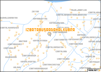
‘Izbat Abū Sa‘ādah al Kubrá (Dumyāţ, Egypt)‘Izbat Abū Sa‘ādah al Kubrá is a town in the Dumyāţ region of Egypt. An overview map of the region around ‘Izbat Abū Sa‘ādah al Kubrá is displayed below.
regional and 3d topo map of ‘Izbat Abū Sa‘ādah al Kubrá, Egypt ::
‘Izbat Abū Sa‘ādah al Kubrá airports ::
The nearest airport is PSD - Port Said, located 66.1 km east of ‘Izbat Abū Sa‘ādah al Kubrá.
Other airports nearby include CAI - Cairo Intl (134.5 km south), ALY - Alexandria Intl (153.2 km west), Nearby towns ::
‘Izbat ash Shaţţ al Baḩrīyah (2.2km south) //
‘Izbat al Murabba‘ (2.4km north west) //
‘Izbat Abū ‘Adawī (3.1km east) //
‘Izbat Abū Lāshīn (3.7km south) //
Kafr Yūsuf (3.4km west) //
Kafr Sharīf (3.5km west) //
Kafr al Wakālah (3.9km north west) //
‘Izbat Sabātāy (4.0km south east) //
‘Izbat Ibrāhīm Ju‘ayşah (3.9km west) //
Kafr al Wasţānī (4.5km north east) //
Kafr Umm as Su‘ūd (4.1km north west) //
Kafr al Aţrash (4.2km south west) //
Kafr al ‘Atal (4.4km south west) //
Minshāt an Naşr (4.3km west) //
An Najāyrah (4.4km west) //
‘Izbat al Bank (4.5km north east) //
‘Izbat aţ Ţūkhī (4.6km south east) //
‘Izbat al Manshīyah (5.3km south) //
Kafr at Tibn (4.6km west) //
‘Izbat Aḩmad Abū as Su‘ūd (5.1km south west) //
‘Izbat Abū Ḩammūdah (5.0km south east) //
‘Izbat Fāţimah Hānīm (5.7km south) //
‘Izbat al Bartūn (5.2km south east) //
‘Izbat Yūsif al ‘Ishsh (5.5km north west) //
‘Izbat Jān ‘Īd (5.4km north west) //
Kafr al Murābi‘īn (5.8km north west) //
Kufûr el-Ghâb (5.8km north west) //
Kafr Abū Fūdah (5.6km south west) //
Kafr ad Dahāʼimah (6.0km north west) //
[all distances 'as the bird flies' and approximate] 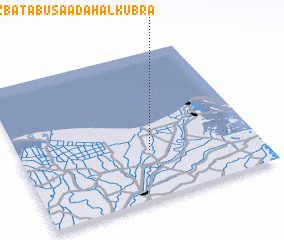 Places with similar names to ‘Izbat Abū Sa‘ādah al Kubrá, Egypt :: Disclaimer :: Information on this page comes without warranty of any kind |
||
|
Where is ‘Izbat Abū Sa‘ādah al Kubrá? Elevation and coordinates ::
Latitude (lat): 31°19'45"N Longitude (lon): 31°32'55"E
Elevation (approx.): 6m (map arrows pan, magnifying glasses zoom) |
||
|
Visiting ‘Izbat Abū Sa‘ādah al Kubrá? Hotel/Accommodation ::
Book a hotel in ‘Izbat Abū Sa‘ādah al Kubrá Travel Guide ::
Buy a travel guide for Egypt rental cars ::
car rental offers GPS waypoint ::
download a GPX waypoint (PoI) of ‘Izbat Abū Sa‘ādah al Kubrá for your GPS receiver
|
||