|
search place name
|
||
As Samā‘inah (Ash Sharqīyah, Egypt)As Samā‘inah is a town in the Ash Sharqīyah region of Egypt. An overview map of the region around As Samā‘inah is displayed below.
regional and 3d topo map of As Samā‘inah, Egypt ::

As Samā‘inah airports ::
The nearest airport is PSD - Port Said, located 65.7 km north east of As Samā‘inah.
Other airports nearby include CAI - Cairo Intl (85.6 km south west), ALY - Alexandria Intl (187.2 km west), Nearby towns ::
Qantīr (2.3km north west) //
Kafr Salmá (2.3km north west) //
Kafr Awlād Zayd (3.0km north east) //
Tall Az̧ Z̧ahīrah (3.1km west) //
Kafr Banī ‘Amr (3.2km south east) //
‘Izbat Ashkur (3.7km south west) //
Al Ḩammādīyīn (3.8km east) //
Kafr Abū Şubayḩ (4.5km south) //
‘Izbat al Munāşrah (4.0km east) //
‘Izbat ‘Arab ash Shams (4.7km south east) //
Sammākīn al Gharb (4.9km north east) //
Ikyād al Baḩrīyah (5.1km south east) //
Naj‘ ‘Abd as Salām (5.3km north) //
‘Izbat al Ghazālī (4.8km north west) //
Ghazālat Abū ‘Abdūn (5.2km south west) //
Kafr ad Darrākah (5.2km south east) //
Manshīyat aş Şawām‘ah (5.7km south) //
Ikyād al Qiblīyah (5.9km south) //
Tir‘at al Awqāf (5.5km north west) //
Qahbūnah (5.3km east) //
Kafr al Wadāʼi‘ah (6.2km south) //
Kafr ash Shabānīyah (6.2km south) //
Kafr al Maḩāsinah (6.2km south) //
Kafr Awlād Manşūr (6.3km south) //
Kafr al Ḩājj ‘Umar (6.4km south) //
Kafr al ‘Aţţār (5.6km west) //
‘Izbat al Malakīyīn Qibliyah (5.7km east) //
Kafr al Waşāylah (6.4km south east) //
Kafr al Maţāwi‘ah (5.7km west) //
[all distances 'as the bird flies' and approximate] 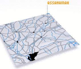 Places with similar names to As Samā‘inah, Egypt ::
Disclaimer :: Information on this page comes without warranty of any kind |
||
|
Where is As Samā‘inah? Elevation and coordinates ::
Latitude (lat): 30°47'21"N Longitude (lon): 31°51'15"E
Elevation (approx.): 12m (map arrows pan, magnifying glasses zoom) |
||
|
Visiting As Samā‘inah? Hotel/Accommodation ::
Book a hotel in As Samā‘inah Travel Guide ::
Buy a travel guide for Egypt rental cars ::
car rental offers GPS waypoint ::
download a GPX waypoint (PoI) of As Samā‘inah for your GPS receiver
|
||