|
search place name
|
||
‘Izbat ‘Arab ash Shams (Ash Sharqīyah, Egypt)‘Izbat ‘Arab ash Shams is a town in the Ash Sharqīyah region of Egypt. An overview map of the region around ‘Izbat ‘Arab ash Shams is displayed below.
regional and 3d topo map of ‘Izbat ‘Arab ash Shams, Egypt ::

‘Izbat ‘Arab ash Shams airports ::
The nearest airport is PSD - Port Said, located 66.1 km north east of ‘Izbat ‘Arab ash Shams.
Other airports nearby include CAI - Cairo Intl (85.2 km south west), ALY - Alexandria Intl (191.5 km west), Nearby towns ::
Kafr Banī ‘Amr (1.7km north west) //
Kafr ad Darrākah (1.8km south west) //
Ikyād al Baḩrīyah (2.4km south west) //
Kafr al Waşāylah (3.0km south) //
Kafr Abū Şubayḩ (3.0km south west) //
Kafr ash Shurafāʼ (3.1km north east) //
Kafr as Sayyid ‘Alī Shūmān (3.1km north east) //
Kafr al ‘Arāʼinah (3.1km north east) //
Al Ḩammādīyīn (3.4km north) //
Ikyād al Qiblīyah (3.3km south west) //
Qahbūnah (3.3km north east) //
‘Izbat al Munāşrah (4.0km north) //
‘Izbat Muwātyah (4.1km south) //
Kafr Awlād Zayd (4.1km north) //
Kafr Awlād Manşūr (4.2km south west) //
‘Izbat al Malakīyīn Qibliyah (4.8km north) //
‘Izbat al Ḩallūfī (4.8km south east) //
‘Izbat Lihayţah (4.6km south east) //
As Samā‘inah (4.7km north west) //
Al ‘Azīzīyah (5.0km south west) //
‘Izbat Khārij az Zimām (5.4km south) //
‘Izbat az Zaghānwah (5.4km south) //
‘Izbat Ḩusayn Farrāj (5.4km south) //
Kafr ash Shabānīyah (5.3km south west) //
Kafr al Maḩāsinah (5.3km south west) //
Kafr al Wadāʼi‘ah (5.3km south west) //
‘Izbat al ‘Awānāt (5.9km south) //
Manshīyat aş Şawām‘ah (5.6km south west) //
‘Izbat az Zarāyqah (5.5km east) //
[all distances 'as the bird flies' and approximate] 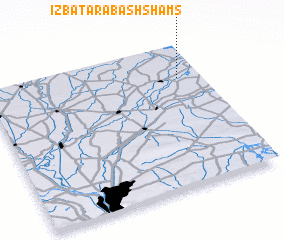 Places with similar names to ‘Izbat ‘Arab ash Shams, Egypt :: Disclaimer :: Information on this page comes without warranty of any kind |
||
|
Where is ‘Izbat ‘Arab ash Shams? Elevation and coordinates ::
Latitude (lat): 30°45'50"N Longitude (lon): 31°53'35"E
Elevation (approx.): 9m (map arrows pan, magnifying glasses zoom) |
||
|
Visiting ‘Izbat ‘Arab ash Shams? Hotel/Accommodation ::
Book a hotel in ‘Izbat ‘Arab ash Shams Travel Guide ::
Buy a travel guide for Egypt rental cars ::
car rental offers GPS waypoint ::
download a GPX waypoint (PoI) of ‘Izbat ‘Arab ash Shams for your GPS receiver
|
||