|
search place name
|
||
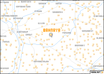
Bahnayā (Ad Daqahlīyah, Egypt)Bahnayā is a town in the Ad Daqahlīyah region of Egypt. An overview map of the region around Bahnayā is displayed below.
regional and 3d topo map of Bahnayā, Egypt ::
Bahnayā airports ::
The nearest airport is CAI - Cairo Intl, located 63.1 km south of Bahnayā.
Other airports nearby include PSD - Port Said (104.7 km north east), ALY - Alexandria Intl (147.5 km west), Nearby towns ::
‘Izbat ‘Alī (1.3km south west) //
Shubrā Şūrah (1.9km north) //
‘Izbat ‘Alī Muḩammad (1.8km south west) //
‘Izbat Abū ‘Asākir (2.4km north) //
‘Izbat Abū Murrah (2.5km north) //
‘Izbat Isḩāq (2.6km north) //
Kafr ‘Abd al Malik Manşūr (2.7km south) //
Kafr al ‘Ukl (2.9km north) //
Kafr Abū Mitnā (2.7km north east) //
Kafr al Miqdām (2.8km south west) //
Mīt al Qurashī (3.1km south west) //
Kafr Dāwūd Maţar (3.3km west) //
Kafr Sulaymān Tādrus (3.3km west) //
‘Izbat ‘Abd al Hādī Badr (3.4km south east) //
Kafr al Bahāytah (3.5km north west) //
Karādīs (3.4km east) //
‘Izbat al ‘Azab Sālim (3.5km west) //
Kafr Barbarī Sulaymān (4.1km south west) //
‘Izbat Muḩammad ‘Abd ar Raḩmān (4.1km north east) //
‘Izbat al Minūfī (4.3km north east) //
Kafr al Libbā (4.7km north) //
Mīt Abū ‘Arabī (4.1km south east) //
‘Izbat Hīlānah (4.8km north) //
‘Izbat Fūdah (4.8km north) //
‘Izbat al Balāţīnī (4.6km south west) //
Tafahnah al Ashrāf (4.3km south west) //
Tafahnah al Ashrāf (4.3km south west) //
Kafr ‘Alī Badrah (4.8km south) //
Kafr Ibrāhīm Yūsif (4.3km west) //
[all distances 'as the bird flies' and approximate] 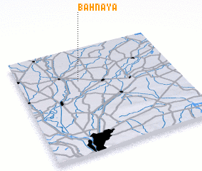 Places with similar names to Bahnayā, Egypt ::
// Banoyo (PH)
// Banuyao (PH)
// Banuyao (PH)
// Banuyo (PH)
// Banuyo (PH)
// Banuyo (PH)
// Bunuaya (PH)
// Banīyah (IQ)
// Ban Ai Yai (TH)
// Ban Ai Yai (TH)
Disclaimer :: Information on this page comes without warranty of any kind |
||
|
Where is Bahnayā? Elevation and coordinates ::
Latitude (lat): 30°41'26"N Longitude (lon): 31°22'58"E
Elevation (approx.): 13m (map arrows pan, magnifying glasses zoom) |
||
|
Visiting Bahnayā? Hotel/Accommodation ::
Book a hotel in Bahnayā Travel Guide ::
Buy a travel guide for Egypt rental cars ::
car rental offers GPS waypoint ::
download a GPX waypoint (PoI) of Bahnayā for your GPS receiver
|
||