|
search place name
|
||
‘Izbat Muḩammad ‘Abd ar Raḩmān (Ash Sharqīyah, Egypt)‘Izbat Muḩammad ‘Abd ar Raḩmān is a town in the Ash Sharqīyah region of Egypt. An overview map of the region around ‘Izbat Muḩammad ‘Abd ar Raḩmān is displayed below.
regional and 3d topo map of ‘Izbat Muḩammad ‘Abd ar Raḩmān, Egypt ::

‘Izbat Muḩammad ‘Abd ar Raḩmān airports ::
The nearest airport is CAI - Cairo Intl, located 65.5 km south of ‘Izbat Muḩammad ‘Abd ar Raḩmān.
Other airports nearby include PSD - Port Said (100.6 km north east), ALY - Alexandria Intl (149.7 km west), Nearby towns ::
‘Izbat al ‘Azab Ḩāmid (0.7km east) //
‘Izbat al Minūfī (0.9km north west) //
‘Izbat Muḩammad al Ḩammār (1.5km north) //
Kafr Abū Mitnā (1.4km south west) //
Al Hawābir (2.1km north) //
‘Izbat al Waqf (2.2km north east) //
Shinbārat Manqallā (2.0km east) //
Karādīs (2.4km south) //
‘Izbat ‘Āmir Dāwūd (2.1km east) //
‘Izbat Muḩammad ‘Abd Allāh (2.4km north east) //
‘Izbat Isḩāq (2.4km west) //
Farghân (2.7km south east) //
‘Izbat Abū Murrah (2.8km west) //
Minshāt Şafwat (3.4km north east) //
Kafr al Libbā (3.3km north west) //
Kafr al ‘Ukl (3.2km west) //
‘Izbat Fūdah (3.5km north west) //
‘Izbat Abū ‘Asākir (3.3km west) //
Shubrā Şūrah (3.3km west) //
Kafr Abū ‘Īd (4.1km north) //
Mīt Abū ‘Arabī (4.1km south) //
‘Izbat Abāz̧ah as Şaghīrah (4.0km south east) //
‘Izbat al Khūlī (4.1km north west) //
‘Izbat ‘Abd al Hādī Badr (4.2km south) //
‘Izbat Al ‘Arab (4.2km north west) //
‘Izbat Hīlānah (4.0km north west) //
Bahnayā (4.1km south west) //
‘Izbat Salāmah Shāhīn (3.9km east) //
‘Izbat Z̧āz̧ah (4.1km east) //
[all distances 'as the bird flies' and approximate] 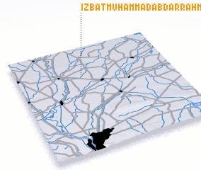 Places with similar names to ‘Izbat Muḩammad ‘Abd ar Raḩmān, Egypt :: Disclaimer :: Information on this page comes without warranty of any kind |
||
|
Where is ‘Izbat Muḩammad ‘Abd ar Raḩmān? Elevation and coordinates ::
Latitude (lat): 30°42'47"N Longitude (lon): 31°25'0"E
Elevation (approx.): 8m (map arrows pan, magnifying glasses zoom) |
||
|
Visiting ‘Izbat Muḩammad ‘Abd ar Raḩmān? Hotel/Accommodation ::
Book a hotel in ‘Izbat Muḩammad ‘Abd ar Raḩmān Travel Guide ::
Buy a travel guide for Egypt rental cars ::
car rental offers GPS waypoint ::
download a GPX waypoint (PoI) of ‘Izbat Muḩammad ‘Abd ar Raḩmān for your GPS receiver
|
||