|
search place name
|
||
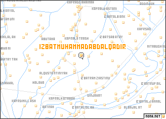
‘Izbat Muḩammad ‘Abd al Qādir (Ad Daqahlīyah, Egypt)‘Izbat Muḩammad ‘Abd al Qādir is a town in the Ad Daqahlīyah region of Egypt. An overview map of the region around ‘Izbat Muḩammad ‘Abd al Qādir is displayed below.
regional and 3d topo map of ‘Izbat Muḩammad ‘Abd al Qādir, Egypt ::
‘Izbat Muḩammad ‘Abd al Qādir airports ::
The nearest airport is PSD - Port Said, located 68.1 km east of ‘Izbat Muḩammad ‘Abd al Qādir.
Other airports nearby include CAI - Cairo Intl (128.0 km south), ALY - Alexandria Intl (150.5 km west), Nearby towns ::
‘Izbat Fāţimah Hānīm (1.3km north east) //
‘Izbat Wahbah ‘Alī (2.0km south west) //
‘Izbat Aḩmad Abū al Wafā (2.0km north west) //
‘Izbat Aḩmad Abū as Su‘ūd (2.5km north) //
‘Izbat Abū Lāshīn (3.0km north) //
Al ‘Ayyādīyah (3.0km south west) //
Kafr al ‘Atal (3.2km north) //
‘Izbat as Sunbāţī (3.0km north west) //
Kafr Abu Zâhir (3.0km north west) //
Kafr Abū Fūdah (3.3km north west) //
Taftīsh Shukrī (3.6km south) //
Al ‘Ayyādīyah (3.4km south west) //
Kafr Abū Sayyid Aḩmad (3.4km north west) //
Kafr al Aţrash (3.8km north) //
Tur‘at Ghunaym (3.5km west) //
‘Izbat al Manshīyah (3.8km east) //
Kafr al Ḩājj Shirbīnī (3.9km west) //
‘Izbat ash Shaţţ al Baḩrīyah (4.5km north) //
‘Izbat al Alf (5.0km south) //
Kafr Sharīf (5.5km north) //
‘Izbat Sanānūh (5.0km west) //
‘Izbat Ramzī Astīnū (5.8km south east) //
‘Izbat Darwīsh ‘Alī (5.7km north west) //
‘Izbat al Khamīs (5.6km north west) //
‘Izbat ‘Abd an Nabī (5.9km north west) //
Kafr Yūsuf (6.6km north) //
Al Ḩişaş (6.6km south) //
‘Izbat al ‘Abd (5.7km east) //
‘Izbat Abū Sa‘ādah al Kubrá (6.7km north) //
[all distances 'as the bird flies' and approximate] 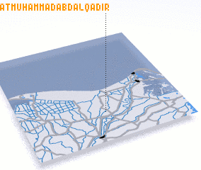 Places with similar names to ‘Izbat Muḩammad ‘Abd al Qādir, Egypt ::
// ‘Izbat Muḩammad ‘Abd al Jalīl (EG)
// ‘Izbat Muḩammad ‘Abd Allāh (EG)
// ‘Izbat Muḩammad ‘Abd Allāh (EG)
Disclaimer :: Information on this page comes without warranty of any kind |
||
|
Where is ‘Izbat Muḩammad ‘Abd al Qādir? Elevation and coordinates ::
Latitude (lat): 31°16'20"N Longitude (lon): 31°31'30"E
Elevation (approx.): 1m (map arrows pan, magnifying glasses zoom) |
||
|
Visiting ‘Izbat Muḩammad ‘Abd al Qādir? Hotel/Accommodation ::
Book a hotel in ‘Izbat Muḩammad ‘Abd al Qādir Travel Guide ::
Buy a travel guide for Egypt rental cars ::
car rental offers GPS waypoint ::
download a GPX waypoint (PoI) of ‘Izbat Muḩammad ‘Abd al Qādir for your GPS receiver
|
||