|
search place name
|
||
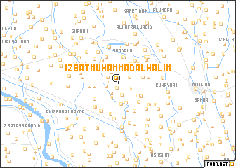
‘Izbat Muḩammad al Ḩalīm (Kafr ash Shaykh, Egypt)‘Izbat Muḩammad al Ḩalīm is a town in the Kafr ash Shaykh region of Egypt. An overview map of the region around ‘Izbat Muḩammad al Ḩalīm is displayed below.
regional and 3d topo map of ‘Izbat Muḩammad al Ḩalīm, Egypt ::
‘Izbat Muḩammad al Ḩalīm airports ::
The nearest airport is ALY - Alexandria Intl, located 83.9 km west of ‘Izbat Muḩammad al Ḩalīm.
Other airports nearby include CAI - Cairo Intl (123.7 km south east), PSD - Port Said (135.9 km east), Nearby towns ::
‘Izbat Şalāḩ Shukrī (0.7km south) //
‘Izbat Iflāţūn (1.0km north) //
‘Izbat an Nashū (1.3km west) //
Ţawīlat Nashart (1.8km south) //
Kafr Yūsuf Ḩinnis (1.8km south west) //
‘Izbat Ḩusayn al Khubī al Kubrá (1.6km west) //
‘Izbat aţ Ţuwāl (1.7km north west) //
‘Izbat Khūrshīd (1.9km north east) //
Ash Shuqqah (2.1km north west) //
Mīt ad Dībah (2.0km east) //
Kafr Yūsuf Dāwūd (2.4km south) //
‘Izbat Ţāhir (2.6km north east) //
‘Izbat Shāhīn (3.1km south) //
Nashart (3.2km south) //
‘Izbat ‘Alī Ibrāhīm (3.3km south east) //
‘Izbat Ḩasan an Naklāwī (3.6km north east) //
‘Izbat Yūsuf ‘Ajlān (3.2km west) //
‘Izbat Yūsuf Şabrī al Jadīdah (3.5km east) //
‘Izbat al Ḩārith (3.6km south east) //
Ḩişşat al Ghunaymī (3.8km north west) //
Ṣandala (4.3km north) //
‘Izbat Şandalā (4.3km north) //
‘Izbat Abū al Jadāyil (4.0km south east) //
‘Izbat Muḩammad Ismā‘īl (4.4km south) //
‘Izbat Abū al Kanāyis (4.3km north west) //
Shabās ‘Umayyir (4.0km south west) //
‘Izbat ‘Abd Allāh al Wakīl (4.2km north east) //
‘Izbat Nājī ‘Ajlān (3.9km west) //
Bilshāshah (4.4km north east) //
[all distances 'as the bird flies' and approximate] 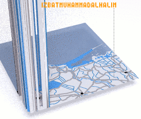 Places with similar names to ‘Izbat Muḩammad al Ḩalīm, Egypt :: Disclaimer :: Information on this page comes without warranty of any kind |
||
|
Where is ‘Izbat Muḩammad al Ḩalīm? Elevation and coordinates ::
Latitude (lat): 31°7'9"N Longitude (lon): 30°49'33"E
(map arrows pan, magnifying glasses zoom) |
||
|
Visiting ‘Izbat Muḩammad al Ḩalīm? Hotel/Accommodation ::
Book a hotel in ‘Izbat Muḩammad al Ḩalīm Travel Guide ::
Buy a travel guide for Egypt rental cars ::
car rental offers GPS waypoint ::
download a GPX waypoint (PoI) of ‘Izbat Muḩammad al Ḩalīm for your GPS receiver
|
||