|
search place name
|
||
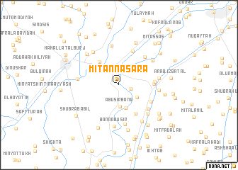
Mīt an Naşārá (Al Gharbīyah, Egypt)Mīt an Naşārá is a town in the Al Gharbīyah region of Egypt. An overview map of the region around Mīt an Naşārá is displayed below.
regional and 3d topo map of Mīt an Naşārá, Egypt ::
Mīt an Naşārá airports ::
The nearest airport is CAI - Cairo Intl, located 92.1 km south of Mīt an Naşārá.
Other airports nearby include PSD - Port Said (102.3 km east), ALY - Alexandria Intl (126.4 km west), Nearby towns ::
‘Izbat Jarrāḩ (1.7km east) //
Samannūd (2.5km north) //
Minyat Samannūd (3.0km north) //
Abū Şīr Banā (3.4km south) //
‘Izbat ad Dayris (3.1km south east) //
Mīt Abū al Ḩāris (3.8km south) //
Ar Rāhibayn (4.5km north west) //
Kafr ash Sharāqwah (5.1km south east) //
Ajā (4.7km east) //
Maḩallat Abū ‘Alī al Qanţarah (5.0km north west) //
Al Baylūq (4.9km east) //
Maḩallat Khalaf (5.6km north) //
Kafr ash Shabrāwī (5.1km south east) //
Manshīyat ‘Abd al Ghanī (5.4km south east) //
Kafr ath Thu‘bānīyah (5.6km north east) //
Mīt Bizzū (6.3km south) //
Kafr aş Şārim al Baḩrī (6.3km north) //
Minshāt ‘Abd an Nabī (5.9km south east) //
Kafr Diyarb Buqţāris (5.5km east) //
Talbant Ajā (5.6km east) //
Sanbukht (6.0km north east) //
Banā Abū Şīr (6.6km south) //
Al Qaşrīyah (6.3km north west) //
Kafr Ḩijāzī (5.7km west) //
As Sinayţah (6.5km south east) //
Buţaynah (6.5km north west) //
An Nāwiyah (7.0km north) //
Shubrā Wīsh (7.2km south) //
Buqţāris (6.4km east) //
[all distances 'as the bird flies' and approximate] 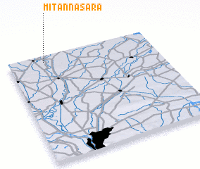 Places with similar names to Mīt an Naşārá, Egypt ::
// Mīt an Naşārá (EG)
// Madenşehri (TR)
// Mutnozero (RU)
// Mīdān az Zīr (LB)
// Médina Sar (SN)
// Meydān Sar (IR)
// Meydān Sar (IR)
// Ma‘tan as Sārah (LY)
// Ma‘dan-e Zarī (IR)
// Matinsaari (FI)
Disclaimer :: Information on this page comes without warranty of any kind |
||
|
Where is Mīt an Naşārá? Elevation and coordinates ::
Latitude (lat): 30°56'26"N Longitude (lon): 31°14'34"E
Elevation (approx.): 16m (map arrows pan, magnifying glasses zoom) |
||
|
Visiting Mīt an Naşārá? Hotel/Accommodation ::
Book a hotel in Mīt an Naşārá Travel Guide ::
Buy a travel guide for Egypt rental cars ::
car rental offers GPS waypoint ::
download a GPX waypoint (PoI) of Mīt an Naşārá for your GPS receiver
|
||