|
search place name
|
||
Calzones (Extremadura, Spain)Calzones is a town in the Extremadura region of Spain. An overview map of the region around Calzones is displayed below.
regional and 3d topo map of Calzones, Spain ::

Calzones airports ::
The nearest airport is SLM - Salamanca, located 113.8 km north east of Calzones.
Other airports nearby include BJZ - Badajoz Talavera La Real (141.5 km south west), VRL - Vila Real (198.7 km north west), BGC - Braganca (211.8 km north), VLL - Valladolid (213.1 km north east), Nearby towns ::
Vinosillas y Espartal (1.9km north) //
Plasencia (3.4km north west) //
Coto y Daca (4.0km north) //
Malpartida de Plasencia (4.0km south) //
Berrocalillo (4.6km north west) //
El Ganso (5.6km north east) //
Umbría de Matasanos (6.0km west) //
Coto Navacebrera y Navahermosa (7.0km north east) //
Fernando Díaz (7.9km north east) //
[all distances 'as the bird flies' and approximate] 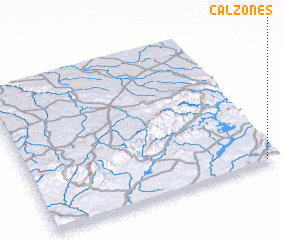 Places with similar names to Calzones, Spain ::
// Claussenius (US)
// Klašnice (BA)
// Callisons (US)
// Golozinci (MK)
// Gualcince (HN)
// Gložanci (HR)
// Calasanz (ES)
// Klučenice (CZ)
// Gällsnäs (SE)
// Quilussanzo (AO)
Disclaimer :: Information on this page comes without warranty of any kind |
||
|
Where is Calzones? Elevation and coordinates ::
Latitude (lat): 40°1'0"N Longitude (lon): 6°3'0"W
Elevation (approx.): 555m (map arrows pan, magnifying glasses zoom) |
||
|
Visiting Calzones? Hotel/Accommodation ::
Book a hotel in Calzones Travel Guide ::
Buy a travel guide for Spain rental cars ::
car rental offers GPS waypoint ::
download a GPX waypoint (PoI) of Calzones for your GPS receiver
|
||