|
search place name
|
||
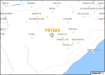
Fatgés (Cataluña, Spain)Fatgés is a town in the Cataluña region of Spain. An overview map of the region around Fatgés is displayed below.
regional and 3d topo map of Fatgés, Spain ::
Fatgés airports ::
The nearest airport is REU - Reus, located 33.3 km north east of Fatgés.
Other airports nearby include BCN - Barcelona (111.2 km east), LEU - Seo De Urgel (153.6 km north), ZAZ - Zaragoza Ab (169.4 km north west), GRO - Gerona Girona (190.0 km north east), Nearby towns ::
Remullá (2.8km east) //
Vandellós (3.4km south east) //
Castelló (5.6km south east) //
Tivisa (5.6km west) //
Mas Boquera (5.9km east) //
Pratdip (5.9km east) //
Capsanes (7.5km north) //
Llavería (7.0km north east) //
Serra de Almós (7.0km north west) //
Guiamets (8.5km north west) //
[all distances 'as the bird flies' and approximate] 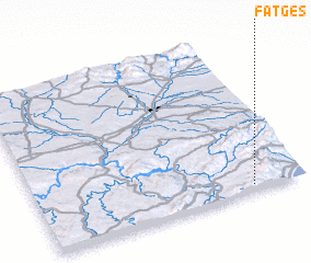 Places with similar names to Fatgés, Spain ::
Disclaimer :: Information on this page comes without warranty of any kind |
||
|
Where is Fatgés? Elevation and coordinates ::
Latitude (lat): 41°2'0"N Longitude (lon): 0°48'0"W
Elevation (approx.): 452m (map arrows pan, magnifying glasses zoom) |
||
|
Visiting Fatgés? Hotel/Accommodation ::
Book a hotel in Fatgés Travel Guide ::
Buy a travel guide for Spain rental cars ::
car rental offers GPS waypoint ::
download a GPX waypoint (PoI) of Fatgés for your GPS receiver
|
||