|
search place name
|
||
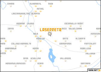
La Serreta (Comunidad Valenciana, Spain)La Serreta is a town in the Comunidad Valenciana region of Spain. An overview map of the region around La Serreta is displayed below.
regional and 3d topo map of La Serreta, Spain ::
La Serreta airports ::
The nearest airport is ALC - Alicante, located 20.1 km south east of La Serreta.
Other airports nearby include MJV - Murcia San Javier (69.7 km south), VLC - Valencia (122.9 km north), LEI - Almeria (225.2 km south west), Nearby towns ::
Las Norias (2.4km south east) //
Monforte del Cid (2.4km south east) //
Estación (2.9km west) //
Pozoblanco (3.4km north east) //
Novelda (3.4km south west) //
Mola (4.4km west) //
Orito (4.7km south east) //
Garroferos (5.7km south east) //
Amoloig (5.7km south east) //
Aljau (6.3km south west) //
Aspe (6.3km south west) //
Horna (7.1km south west) //
Escandella (6.9km north east) //
La Jaud (6.9km north west) //
Almafrá (8.6km north west) //
[all distances 'as the bird flies' and approximate] 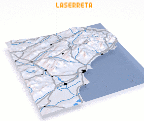 Places with similar names to La Serreta, Spain ::
// Lazareto (PH)
// Lizard (US)
// Lasarat (ET)
// Lazzaretto (IT)
// Lazzeretto (IT)
// Lazareto (PT)
// La Sierrita (CU)
// La Suerte (CU)
// Lazarat (AL)
// Lazaret (RO)
Disclaimer :: Information on this page comes without warranty of any kind |
||
|
Where is La Serreta? Elevation and coordinates ::
Latitude (lat): 38°24'0"N Longitude (lon): 0°44'0"W
Elevation (approx.): 255m (map arrows pan, magnifying glasses zoom) |
||
|
Visiting La Serreta? Hotel/Accommodation ::
Book a hotel in La Serreta Travel Guide ::
Buy a travel guide for Spain rental cars ::
car rental offers GPS waypoint ::
download a GPX waypoint (PoI) of La Serreta for your GPS receiver
|
||