|
search place name
|
||
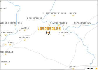
Los Rosales (Andalucía, Spain)Los Rosales is a town in the Andalucía region of Spain. An overview map of the region around Los Rosales is displayed below.
regional and 3d topo map of Los Rosales, Spain ::
Los Rosales airports ::
The nearest airport is SVQ - Sevilla, located 24.1 km south west of Los Rosales.
Other airports nearby include OZP - Sevilla Moron Ab (46.2 km south), ODB - Cordoba (81.7 km east), XRY - Jerez (98.0 km south), AGP - Malaga (147.9 km south east), Nearby towns ::
San José (1.9km north) //
Tocina (3.7km north) //
Villanueva del Río (4.7km north east) //
Guadajoz (4.4km east) //
Alcolea del Río (5.8km north east) //
Villanueva del Río y Minas (7.6km north) //
Alcornocalejo (7.1km north west) //
[all distances 'as the bird flies' and approximate]  Places with similar names to Los Rosales, Spain ::
// Las Rosuelas (ES)
// Los Rosales (ES)
// Los Rosales (ES)
// Los Riecillos (CL)
// Los Arrozales (SV)
// Las Rosillas (MX)
// Los Rosales (MX)
// Los Rosales (MX)
// Los Arrozales (HN)
// Los Rosales (VE)
Disclaimer :: Information on this page comes without warranty of any kind |
||
|
Where is Los Rosales? Elevation and coordinates ::
Latitude (lat): 37°35'0"N Longitude (lon): 5°43'0"W
Elevation (approx.): 33m (map arrows pan, magnifying glasses zoom) |
||
|
Visiting Los Rosales? Hotel/Accommodation ::
Book a hotel in Los Rosales Travel Guide ::
Buy a travel guide for Spain rental cars ::
car rental offers GPS waypoint ::
download a GPX waypoint (PoI) of Los Rosales for your GPS receiver
|
||