|
search place name
|
||
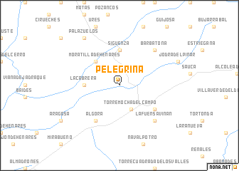
Pelegrina (Castilla-La Mancha, Spain)Pelegrina is a town in the Castilla-La Mancha region of Spain. An overview map of the region around Pelegrina is displayed below.
regional and 3d topo map of Pelegrina, Spain ::
Pelegrina airports ::
The nearest airport is TOJ - Madrid Torrejon, located 89.7 km south west of Pelegrina.
Other airports nearby include MAD - Madrid Barajas (97.9 km south west), ZAZ - Zaragoza Ab (151.5 km north east), VIT - Vitoria (207.4 km north), PNA - Pamplona (211.3 km north), Nearby towns ::
Torremocha del Campo (4.0km south) //
Moratilla de Henares (4.6km north west) //
Sigüenza (5.6km north) //
La Cabrera (4.2km west) //
La Torresaviñan (5.6km south east) //
Algora (6.2km south west) //
Barbatona (7.0km north east) //
La Fuensaviñán (7.0km south east) //
Palazuelos (8.5km north west) //
[all distances 'as the bird flies' and approximate]  Places with similar names to Pelegrina, Spain ::
// Pulgarn (AT)
// Polkern (DE)
// Pellegrina (IT)
// Pellegrini (IT)
// Pellegrino (IT)
// Pellegrino (IT)
// Pallikárion (GR)
// Pawłów Górny (PL)
// Pelguranna (EE)
// Polkorona (LV)
Disclaimer :: Information on this page comes without warranty of any kind |
||
|
Where is Pelegrina? Elevation and coordinates ::
Latitude (lat): 41°1'0"N Longitude (lon): 2°38'0"W
Elevation (approx.): 997m (map arrows pan, magnifying glasses zoom) |
||
|
Visiting Pelegrina? Hotel/Accommodation ::
Book a hotel in Pelegrina Travel Guide ::
Buy a travel guide for Spain rental cars ::
car rental offers GPS waypoint ::
download a GPX waypoint (PoI) of Pelegrina for your GPS receiver
|
||