|
search place name
|
||
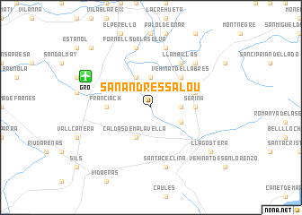
San Andrés Salou (Cataluña, Spain)San Andrés Salou is a town in the Cataluña region of Spain. An overview map of the region around San Andrés Salou is displayed below.
regional and 3d topo map of San Andrés Salou, Spain ::
San Andrés Salou airports ::
The nearest airport is GRO - Gerona Girona, located 7.1 km north west of San Andrés Salou.
Other airports nearby include BCN - Barcelona (89.2 km south west), PGF - Perpignan Rivesaltes (97.1 km north), LEU - Seo De Urgel (128.9 km north west), CCF - Carcassonne Salvaza (156.0 km north), Nearby towns ::
Vehinat de las Ferreríes (3.7km north) //
Vehinat de Montroig (2.8km east) //
Riudellots de la Selva (4.0km north) //
Caldas de Malavella (4.0km south) //
Vehinat de Esclet (3.3km south east) //
Vehinat de Llabrés (4.6km north east) //
Seriñá (4.1km east) //
Franciach (4.1km west) //
Cassá de la Selva (4.5km north east) //
Llambillas (6.2km north east) //
Fornells de la Selva (7.5km north) //
Quart dʼOnyar (7.5km north) //
Santa Ceclina (7.5km south) //
San Cristóbal (6.9km north east) //
Llagostera (7.8km south east) //
Aiguaviva (9.2km north west) //
[all distances 'as the bird flies' and approximate]  Places with similar names to San Andrés Salou, Spain :: Disclaimer :: Information on this page comes without warranty of any kind |
||
|
Where is San Andrés Salou? Elevation and coordinates ::
Latitude (lat): 41°52'0"N Longitude (lon): 2°50'0"E
Elevation (approx.): 109m (map arrows pan, magnifying glasses zoom) |
||
|
Visiting San Andrés Salou? Hotel/Accommodation ::
Book a hotel in San Andrés Salou Travel Guide ::
Buy a travel guide for Spain rental cars ::
car rental offers GPS waypoint ::
download a GPX waypoint (PoI) of San Andrés Salou for your GPS receiver
|
||